about us | links | permit info
Subscribe to Hiking With My Brother Email Subscribe Follow Hiking With My Brother on Facebook Follow Hiking With My Brother on Twitter Hiking With My Brother Picasa Hiking With My Brother YouTube

Gleason Hill

Our Hiking Time: 4h
Total Ascent: 850ft
Highest Point: 2300ft
Total Distance: 9.0 miles
Location: N 47° 2.07, W 122° 1.368
Required Permit: None
Difficulty: Easy

Nathan's Photo
A few weeks ago we headed out to the Carbon River to continue exploring an area steeped in history. This time we were headed to Gleason Hill to try and locate an old sawmill we’d found some references to. While we never found what we were looking for, we did manage to put together an interesting little hike that works well as a winter outing.

Gleason Hill sits on the east side of the Carbon River opposite the townsite of Fairfax. The former coal and lumber town was platted in 1897 and supported a bustling population for nearly 50 years before being abandoned in the 1940. Another community thrived on the other side of the river at the base of Gleason Hill. Known as Upper Fairfax, the town focused on logging the forests atop Gleason Hill. In the 1930s, the Civilian Conservation Corps built a road along the river to help expand access to Gleason Hill’s timber. The Fairfax CCC Road is still being used today, and most of this hike follows that road. Today, there are still a few houses in Upper Fairfax, but the industry is long gone.

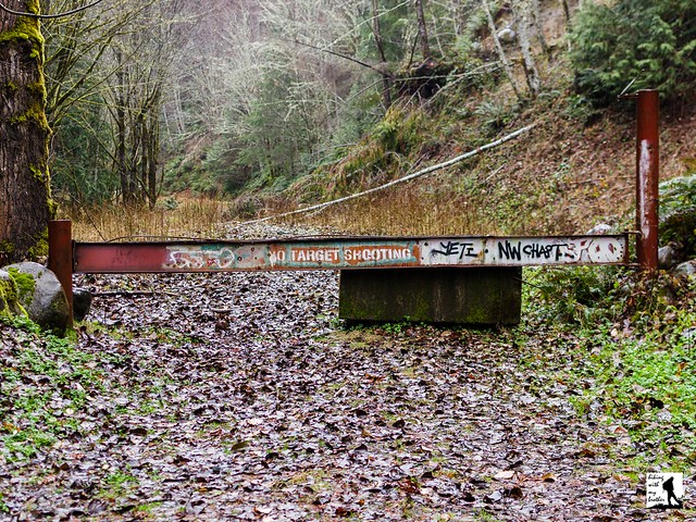
The hike begins at an unmarked and gated forest road. Step around the gate and over a stream, following the rough road as it begins its gradual ascent. Although the young mixed forest offers occasional glimpses of the Carbon River and nearby mountainsides, most of the route is confined to the trees. At about the two mile mark, find what remains of an old forest road that provided quick access to Gleason Hill’s upper reaches. The roadbed is very overgrown and disappears almost entirely after a short distance. If you’re looking for a short cut and a little adventure, it is a fairly easy bushwack up to the forest road.

Continue onward for another mile or so, passing the occasional waterfall to a junction with another road. Veer right, continuing on the road as it begins to hook around the base of Gleason Hill. Find another forest road here that heads up the ridgeline. Turn right and follow for another mile or past vast expanses of clear cut to reach the tree-covered summit. Nothing marks the top other than the beginning of a gentle descent. You can end your hike here or continue onward to see where the roads take you.

This hike is best if you’re up for doing some explorations and a little bushwhacking. The route we’ve mapped out here is just a baseline for getting around. The real adventure is in the network of roads that riddle the area. We were told that there are some artifacts and old foundations to explore, but we did not have any luck finding them. This hike doesn’t have big views or a lake to hike to.  It's simply a pleasant forest walk that stays fairly snowfree throughout the year. In addition, because it isn't an area that many people frequent, Gleason Hill is an excellent choice if it's solitude you seek.

To get there, take I-5 South to I-405. From I-405 take SR 167 south toward Auburn. In 20 miles take the SR 410 Exit toward Sumner/Yakima. Follow SR 410 for 12 miles to SR 165. Take a right and continue on SR 165 for about 10 miles through Carbonado to the Fairfax Bridge. Cross the bridge and continue on SR 165 for a half-mile. Veer left onto the Carbon River Road when the highway splits, and follow for 2.9 miles to the Manley-Moore Road. Take a left and follow the Manley Moore Road for .3 miles to Kolisch Road, keeping left. Continue .5 miles across the Carbon River to a gated forest road with plenty of room for parking. -Nathan


Print Google Directions >>
Gleason Hill

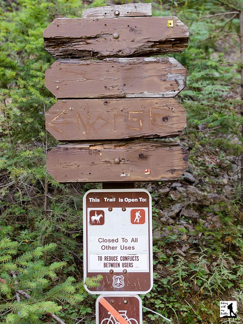
Norse Peak Trail #1191

Our Hiking Time: 4h
Total Ascent: 2900ft
Highest Point: 6856ft
Total Distance: 10 miles
Location: N 46° 57.408,  W 121° 27.162
Required Permit: None
Difficulty: Moderate

Nathan's Photo
A few months ago, before the snows began to creep down the moutainsides, we had a chance to return to the Highway 410 area to tackle a summit we’d heard great things about. Boasting a former lookout site, big views of Mt. Rainier and the surrounding landscape, and access to some pristine alpine wilderness areas, it was a hike that had long been on our list. Despite its proximity to the Crystal Mountain Ski Resort, our hike up Norse Peak delivered everything it promised and more.

With its front porch views of Mt. Rainier, hikers and climbers have been finding their way to the top of the 6,856-foot Norse Peak for a long time. Originally dubbed “Swede Butte” in reference to a local ranger’s nickname, Forest Service officials ultimately decided the name was a little too undignified and renamed it Norse Peak. In 1931, a lookout cabin was built at the summit where it remained in use until it was destroyed in 1956. Today’s trail follows the same route used by lookouts to access the cabin and haul in supplies. In 1984, Congress established the Norse Peak Wilderness, preserving what is now more than 50,000 acres of wilderness.

The Norse Peak Trail #1191 begins directly from the side of a forest road, climbing steeply through a young forest of fir. As you continue to switchback up the narrow and dusty trail, the forest beings to thin, and after about a mile, you can catch the first glimpses of the views to come. Peer down at the bustling lodges and parking lots of Crystal Mountain Resort and up to the restaurant perched atop of Crystal Mountain. At about the two mile mark, you’ll reach the junction with the Goat Lake Trail #1161. Keep right and push upward through patches of trees punctuated with alpine meadows that burst with wildflowers in the late spring.

After roughly four miles of climbing, reach the ridgeline and the junction with the Norse Peak View Trail 1191.1. Continue following the ridgeline up another half-mile, crossing into the Norse Peak Wilderness before reaching the summit. Little evidence of the lookout cabin remains beyond bits of glass and stray wire, though a half-circle of rocks provides a comfortable place to take in the big views. Settle in to enjoy the ocean of moutaintops stretching out in all directions. Mt. Rainier dominates the western skyline and looks almost close enough to touch. As you swing northward, look for the snow-capped Olympic Mountains in the distance, before picking out Mt. Stuart and Glacier Peak. Turn east to find the aptly named Basin Lake below and Fifes Peaks and Goat Peak in the distance. Mt. Adams is to the south along with nearby Gold Hill and on very good days, you can just make out the top of Mt. Hood.

The views on this one are tremendous and more than worth the effort to reach them. Admittedly, it is possible that the views from the top of Crystal Mountain are similar, but you’re guaranteed to have a lot less company on Norse Peak. Most hikers should not have too much difficulty with this ascent, and for those looking for more distance, it’s easy to extend this hike out to Big Crow Basin or Goat Lake. Between the big views, prominent wildflowers, easy access to the Pacific Crest Trail, and the nearby equestrian camp, this hike sees a lot of boots and hooves. Come prepared to share the trail during the summer months.

To get there, take I-5 south to Highway 18 Exit 142A. Follow Highway 18 into Auburn and take the SR 164 exit. Head left on SR 164 through Enumclaw to SR 410. Head left onto SR 410 for 32.5 miles to Crystal Mountain Road (FR 7190). Turn right and follow the road for 4.3 miles to the junction with FR 7190-410 (also known as Gold Hill Road). Park on the shoulder and hike up FR 7190-410 about 0.2 miles to the trailhead. -Nathan

Print Google Directions >>

Norse Peak

Honeymoon & Independent-Index Mines via Lake Serene Trail #1068

Our Hiking Time: 2h 30m
Total Ascent: 1000ft
Highest Point: 1500ft
Total Distance: 4.2 miles
Location: N 47° 47.418, W 121° 34.212
Required Permit: Northwest Forest Pass
Difficulty: Moderate

Nathan's Photo
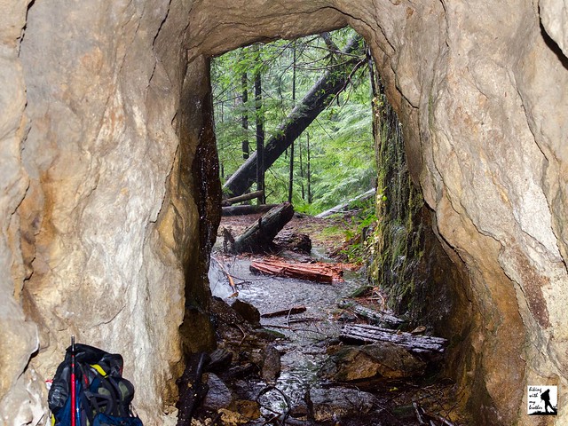
During our research on the Lake Serene Trail #1068, we ran into a number of references to different mines that could be found on the slopes of Mt. Index. Curious, we made a few return trips to the area to see if we could find some of the area’s rich mining past. After some bushwacking and creative route finding, we were able to locate two mines just off the main trail: The Honeymoon Mine and the Index-Independent Mine.

Back in 1898, the promise of mineral wealth brought prospectors to Mt. Index. A number of exploratory tunnels were dug before claims were staked. The Index Mining Company had the largest concentration of claims, which included Mystery, Pride of Index, Sixteen to One, the Crown Jewel and the Copper Queen. By 1902, the Independent Mining Company had become involved and the claims were collectively known as the Index-Independent Mine. Most of the work was on the Sixteen to One claim, which included three tunnels, each hewn from the rock at progressively higher elevations. The largest was at the lowest elevation, and can still be accessed today. From 1902-1907, copper ore was mined and sent down the mountain to Index. The mine was then abandoned until 1949, when the Lake Serene Mining Company took over and worked the claim until 1951. For this reason, the mine is sometimes referred to as the Lake Serene Mine. As for the Honeymoon Mine, less is known about it, as it is less a mine than simply a tunnel into the mountainside. It never produced much of anything, and after chipping out 250 feet of rock, the effort was abandoned.

The hike begins from the Lake Serene Trailhead, following a logging road for .1 miles before branching off onto the Lake Serene Trail. Enjoy the wide, relatively flat trail as it continues gradually through a mixed forest, crossing over a number of small creeks and streams. This portion of the trail follows an abandoned roadbed, one that was likely used to transport minerals down from the mines. While nature has done a decent job of reclaiming the former road, there are a few sections that feel like a truck filled with coal could come rumbling around the corner. This is especially true for those shadowy sections that run alongside the rocky cliffs created when the road was blasted from the mountainside.

After 1.5 miles you’ll pass a forest road branching left off the main trail. Ignore this road and continue a short distance to another road branching off to the right. Turn right and follow the road for a little less than .2 miles to a large clearing, once the parking lot for the Lake Serene Trailhead. From here, listen for the nearby creek as it tumbles down the cliffs above. The Index-Independent Mine is tucked into the cliffs next to the creek, and a rough bootpath leads up to the tunnel. Also nearby is a memorial to three hikers that were killed in an avalanche here in late 1996. Find it by following what remains of the roadbed a few hundred feet up to the rock face, and following the path to a small stone circle. Once you’re done exploring the area, head back down to the main trail and continue about .1 miles to a junction with the Bridal Veil Falls Trail.

Head right up the rocky Bridal Veil Falls trail, crossing over a few large streams and catching the occasional view of the South Fork Skykomish Valley. Continue switchbacking up the trail, and as you approach the crashing sound of Bridal Veil Falls, keep an eye out for the first in a series of wooden boardwalks. From the first boardwalk, turn right into the forest, heading toward a small waterfall a few dozen feet up the mountain, largely hidden in the trees. As you work your way toward the water, find a small gully providing easy access up the mountainside. After a short scramble you’ll end up on a small plateau at the base of the falls. The Honeymoon Mine is just to the left of the falls. After you’ve had your fill of the mine, head back down and spend some time at Bridal Veil Falls and the big views of the valley below.

Because they are fairly low on the mountain, these mines are a great winter outing or they work well as side trips on your way up to Lake Serene. The lack of real trails to the mines means that this adventure may not be for everyone, but they are so close to the trail that if you don’t mind some off-trail explorations you won’t have much difficulty reaching the mines. As always, use caution around the tunnels, as they can be dangerous. Do not enter the mines unless you have the appropriate gear and experience to do so.

To get there, take Highway 2 out toward Index. Keep an eye out for the Mt. Index road on the right near milepost 35. Take the Mt. Index Road for about a half-mile, following the signs directing you to the Lake Serene Trailhead and parking lot. Privy available. -Nathan

Print Google Directions >>

Honeymoon & Index-Independent Mines
Copyright 2008-2016 - hikingwithmybrother.com
hikingwithmybrother@gmail.com