about us | links | permit info
Subscribe to Hiking With My Brother Email Subscribe Follow Hiking With My Brother on Facebook Follow Hiking With My Brother on Twitter Hiking With My Brother Picasa Hiking With My Brother YouTube

Wilkeson Townsite

Our Hiking Time: 1h
Total Ascent: 50ft
Highest Point: 850ft
Total Distance: 1.1 miles
Location: N 47° 6.132, W 122° 2.424
Required Permit: None
Difficulty: Easy

Nathan's Photo
Last spring we spent a weekend in the Carbon River Valley exploring a number of mines, townsites and other historical areas. We hoped to put together a series of short hikes that would highlight the area’s rich mining history. One of the sites we visited was the town of Wilkeson, where we managed to piece together enough trail to make a decent winter hike.

Back in the late 1870s, coal was discovered along the Carbon River and a small community began to form along a creek near the riverside. Among the residents of that community was Samuel Wilkeson, who served on the Northern Pacific Board of Directors and moved to Wilkeson in 1876. By the time the Northern Pacific Railway extended track from Tacoma to the creek in 1877, both the creek and the community were named Wilkeson, in Samuel Wilkeson’s honor. With the arrival of the train, coal production went into full swing. Coal was pulled from the ground and put into coking ovens to produce coke, which was (and still is) used as an industrial fuel. The coke would then be loaded onto trains and shipped to Tacoma for use.

As the coal became more difficult to access, enterprising prospectors found extensive sandstone formations and built a quarry that began in 1886 and that still operates today. Wilkeson sandstone has been used in buildings all over Washington, perhaps most prominently on the exterior of state capitol. The town was officially incorporated in 1909.

The tour begins with a visit to the coking ovens, located just off Railroad Avenue in Wilkeson. The ovens sit in a small parade ground that also contains a long section of railroad track that is used during Wilkeson’s annual railroad handcar races. The battery of ovens are now covered in vegetation, but there is easy access to the interior of a number of the ovens, as the brick-lined ceilings have begun to collapse over time. Once you’ve explored the ovens, follow the faint indications of trail that parallel Railroad Avenue and enter a lightly wooded area. After a short distance you’ll encounter a large concrete structure covered in grafitti. Our research didn’t turn up anything that told us what was once here, but we assume it has some connection to the nearby Skookum Slope Mine that was re-opened for a few years in the 1940s.

Press onward following Wilkeson Creek to a large clearing. On the far side of the clearing you find easy access to Railroad Avenue and the entrance to the Wilkeson Sandstone Quarry. While it’s private property and visitors are not allowed without prior permission, there is nothing wrong with walking up to the entrance taking a peek at the equipment and the massive stone cutting operation that has been chugging along for over 100 years. When you’re ready, double back the way you came and return to the concrete structure. From here, follow the trail up a small berm to find views of the Skookum Slope Mine at the end of a pond on the opposite site of Wilkeson Creek. Water still spills out of the grated mine entrance, and the small concrete foundation in the middle of the pond is the fan house that once pumped air into the mine shaft. Continue following the trail up the berm and notice how out of place the hill feels. That is because it’s not a hill at all, but rather a massive pile of slag and leavings from the mine that nature has since reclaimed. Soon the trail swings downhill and deposits you back at the coking ovens and the start of your tour.

Short and sweet, this hike works best during the winter months, when there will be a minimum of vegetation to get in the way and most other trails are covered in deep snow. The hike is also easily combined with other nearby townsites such as Melmont or Fairfax, which can help fill out a full day of off-season hiking. If you’re looking for an interesting walk through history, we recommend checking Wilkeson out sometime in the near future.

To get there, take I-5 South to I-405. From I-405 take SR 167 south toward Auburn. In 20 miles take the SR 410 Exit toward Sumner/Yakima. Follow SR 410 for a little over 11 miles to Mundy Loss Road. Take a right and continue for 1 mile to SR 162. Take a left and follow SR 162 as it merges into SR 165 and continue for 3 miles into Wilkeson. Turn left onto Railroad Avenue continue for .2 miles to a small parking lot on the right. -Nathan

Print Google Directions >>
Wilkeson Townsite

Evergreen Mountain Lookout Trail #1056

Our Hiking Time: 2h 30m
Total Ascent: 1300ft
Highest Point: 5600ft
Total Distance: 2.6 miles
Location: N 47° 50.1900, W 121° 15.8340
Required Permit: None
Difficulty: Moderate due to steep terrain

Nathan's Photo
Not long ago, just before the snow firmed up its hold on the mountaintops, we headed out toward Stevens Pass to squeeze one more hike along Highway 2 into 2013. We had relatives in tow and needed a hike that was not too difficult, but also offered some decent views. We went with the obvious answer -- the popular Evergreen Lookout Trail which managed to more than deliver on its promise of big views.

Evergreen Mountain is named for the large meadows that cover the flanks of the mountain. Back in 1935, the US Forest Service built a fire lookout cabin on summit as part of its fire-fighting program. During the summer months, a lookout would watch for signs of smoke and radio the ranger station if they saw a fire. During World War II, the cabin was taken over by the Aircraft Warning Service, a band of civilian volunteers organized by the US Army to keep an eye out for enemy aircraft. From 1941 to 1944 members of the Aircraft Warning Service staffed the cabin year-round, ready to scramble fighters to respond to attacking aircraft. In 1944, the US gambled and shifted all of its home defense aircraft to the offensives in Europe and the Pacific. With no one to call if the enemy was spotted, the AWS returned Evergreen Lookout to the US Forest Service.

The lookout continued to be used for fire detection through the 1980s, surviving a large burn that crept up the sides of Evergreen Mountain in 1967. Remnants of that fire can still be seen along the trail today. When flooding washed out a forest road and added seven miles to the trail, the cabin fell into disrepair. Luckily, in the 1990s it was adopted by the Seattle Explorer Search and Rescue Group, a group of Explorer Scouts that focus on search and rescue training and wilderness survival skills. The restoration was done with the support of the Mountaineers, the Quest School and 141st Army Reserve Aviation Battalion. Today, you can rent the cabin through the Forest Service and take your turn at watching over the wilderness.

The Evergreen Mountain Trail #1056 begins from the forest road, climbing quickly through meadows and past the charred and bleached reminders of the 1967 burn. As you climb, keep an eye out for the huckleberry and mountain blueberry that are plentiful along the route. The narrow trail wastes little time ascending the ridge toward mature stands of hemlock and fir. Plunge into the forest and after two-thirds of a mile enter the Wild Sky Wilderness and the trail begins to level out. Continue through the trees to large alpine meadows filled with wildflowers in season. From here you can see your destination perched in the distance. Push up the last few switchbacks and soon find yourself on Evergreen Lookout’s front porch.

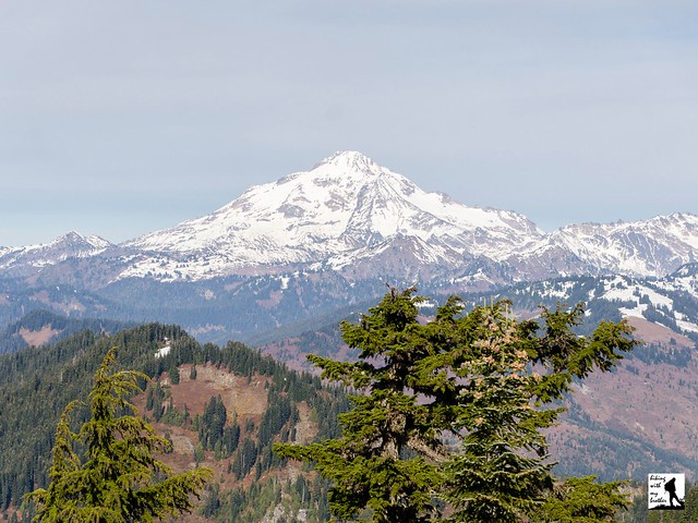
The 360-degree views are vast. To the north, Glacier Peak rises above the surrounding mountains. Pick out Columbia, Kyes and Sloan Peaks to the left of Glacier. Continue turning west to first pick out Del Campo Peak and Big Four Mountain, followed by Gunn and Merchant Peak, then Baring Mountain. As you turn south find Mt. Rainier dominating the skyline, rising over nearby Beckler Peak and Alpine Baldy. As you turn east find Mount Daniel and Mount Fernow, followed by Mount Stewart and finally the rolling mountains of the Henry M. Jackson Wilderness including nearby Scrabble Mountain and Grizzly Peak. Settle in and see how many more you can pick out.

Despite the roughly 20 miles of forest roads that must be navigated to reach the trailhead, the spectacular views draw plenty of hikers every year. While is a great hike if you’re looking for big rewards on a short trail, it’s a lot of driving for just over 2.5 miles of trail. The trail is probably a little too steep and rugged for the youngest of hikers, but everyone else should be able to tackle this one without too much of a problem. If you’re looking for more trail time, we recommend combining this hike with another nearby trail, such as Beckler Peak or Scorpion Mountain.

To get there, take Highway 2 out just beyond Skykomish to milepost 50. Take a left onto FR 65, also known as the Beckler River Road. After 7 miles the pavement ends at an intersection. Veer left and continue on FR 65 for .7 miles to FR 6550. At this point, you can continue on FR 65 to Jack’s Pass to the other end of FR 6550, or cut out a few miles and jump on FR 6550 now. If you’re looking to save time, veer right onto FR 6550 and continue for 4.3 miles to FR 6554. Hook right and take FR 6554 another 8 miles to the trailhead at road’s end. -Nathan

Print Google Directions >>

Evergreen Lookout

Walt Bailey Trail to Cutthroat Lakes & Bald Mountain

Our Hiking Time: 5h 30m
Total Ascent: 2100ft
Highest Point: 4800ft
Total Distance: 9.0 miles
Location: N 47° 59.904, W 121° 39.318
Required Permit: None
Difficulty: Hard due to rough trail and navigation

Nathan's Photo
A few months ago we stumbled onto a story about the Walt Bailey Trial - a volunteer effort to rebuild a lost trail that once led out to a set of pristine alpine lakes and big views of Spada Lake. We couldn’t resist taking the trek out along the Mountain Loop Highway to see it for ourselves.
  
During the Stillagumish River’s mining heyday back around the turn of the last century, miners would begin working claims all along the river. One enterprising miner began working a claim at the mouth of a creek along the Stilliguamish, but never bothered to officially file the claim. Perhaps for that reason, folks just started referring to the creek by the name of the miner: Mallardy. Over the years Mallardy Creek and Mallardy Ridge have played host to innumerable travelers making their way up the ridge to Cutthroat Lakes and beyond.

Back in the 1930s, the Mallardy Ridge Trail ran from the Stillaguamish River up the mountainside to the Blackjack Ridge fire lookout before circling back down to the river. The pole tower lookout was built in 1935 and a cabin was added in 1942. In 1950, the decision was made to remove the lookout and the trail fell into disuse. At the same time, logging activities destroyed some sections of the trail. What was left of the trail was abandoned and it wasn’t until 1991 that former Civilian Conservation Corps veteran Walt Bailey began work on an alternative route for the Mallardy Ridge Trail. Built entirely by volunteers, including the then 73-year-old Bailey, the Mallardy Ridge Trail (often called the Walt Bailey Trail) provides access to Cutthroat Lakes and connects up to the Bald Mountain Trail.

The Mallardy Ridge (Walt Bailey) Trail #706 begins from the end of the forest road and enters a mixed forest of alder, cedar and hemlock. The narrow trail wanders through the trees to broad meadows dotted with marshy ponds. After about a mile, the trail enters the Morning Star Natural Resource Conservation Area (NCRA), which protects over 33,000 acres of land around Spada Lake. The sign at the trailhead and some trail guides reference the Mt. Pilchuck NCRA, which no longer exists. Back in 2007 the Mt. Pilchuck and Greider Ridge NCRAs were merged into today’s Morning Star NCRA.

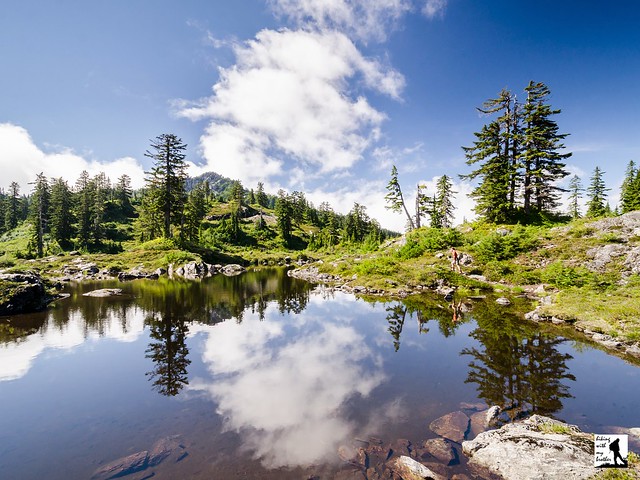
Beyond the largest of the alpine meadows, the trail steepens and begins to switchback up through fields of talus toward Cutthroat Lakes. Arrive at the ridgeline to a small tarn with views of the lakes below. Follow the winding path as it descends down to the lakes. Along the way, numerous way paths branch off from the trail providing access to lakeshores. Stay on the widest path as it curves around the lakes and begins to climb up toward Bald Mountain. Switchback up the mountainside to the ridge, then climb up the back of the mountain to the summit. The views from the top are enormous. To the south, Mt. Rainier rises above the Spada Lake and Sultan Basin. Turn to the east to find Del Campo and Vesper Peaks, Big Four Mountain and Mount Pugh. To the north pick out Three Fingers and Whitehorse Mountain. Mt. Pilchuck can be seen to the west. Settle in and see how many mountaintops you can name.

This is a great trail with a little bit of everything - old growth forest, alpine lakes, big views, and not a lot of traffic. The trek to the top of Bald Mountain does involve a decent amount of elevation gain, but most hikers should have no problem reaching Cutthroat Lakes, which are a destination unto themselves.  Keep in mind that this is a volunteer-built trail - some sections are rough and can be a little difficult to follow.  Still, the added difficulty is more than worth the extra effort.  If you haven’t already, put the Walt Bailey Trail on your list to hike in the near future.

To get there, take I-5 North to Exit 194. Follow Highway 2 for about two miles. Stay in the left lane and merge onto Lake Stevens Highway 204. Follow for two miles to Highway 9. Take the left onto Highway 9 toward Lake Stevens. In just under two miles reach Highway 92 to Granite Falls. Take a right and follow for about nine miles to the Mountain Loop Highway. Follow the MLH for 17.8 miles to Mallardy Road (aka FR 4030). Turn right and follow the road 1.3 miles to FR 4032. Veer right onto FR 4032 and continue 5.7 miles to the end of the road and the trailhead. -Nathan

Print Google Directions >>

Walt Bailey Trail

Murhut Falls Trail #828

Our Hiking Time: 1h
Total Ascent: 300ft
Highest Point: 1100ft
Total Distance: 1.6 miles
Location: N 47° 40.422, W 123° 3.018
Required Permit: None
Difficulty: Easy

Nathan's Photo
Earlier this year we spent a weekend tromping around the Olympic Peninsula exploring a number of out-of-the-way hikes. One of our stops was Murhut Falls, a short jaunt out to a surprisingly impressive set of cascades tucked deep into a mossy ravine.

Murhut Falls is just one of quite a number of waterfalls along Murhut Creek, which flows down the flanks of  Murhut Ridge. Despite a somewhat unusual name, we have yet to track down the story behind “murhut,” though we can find references to Murhut Creek as far back as the 1920s. Much of the area was logged around the turn of the last century, a legacy that can still be seen on the sawed-off stumps that linger along the trail to this day. Times have changed, and there are now efforts underway by conservationist groups to extend the protections of The Brothers Wilderness to Murhut Falls and parts of the trail.

Some work has already gone into making Murhut Falls a little more accessible. The hike has always been a little off the beaten path, and likely because of that the trail to the falls had come degraded and somewhat treacherous. Thankfully, the trail was recently rehabilitated by the Forest Service, and the path and area around the base of the falls is in much better shape.

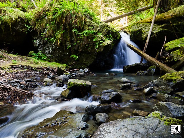
From the trailhead, the route begins along a former logging road, rising gently through a young forest filled with rhododendrons. The wide, smoothly graded trail soon levels out and enters stands of old growth. Eventually the logging road ends and you will find yourself on proper trail hugging the mountainside and providing a few peeks at Mt. Jupiter and Jupiter Ridge. Before long, the trail abruptly turns and climbs into a steeply-walled ravine. Lush and mossy, the ravine feels close and remote, as if you’ve suddenly been transported deep into the wilderness. Continue to the end of the trail to find the two-tiered Murhut Falls tumbling down between two large pools. Find a good spot to enjoy the view or do a little exploring near the base of the falls.

With short mileage and little elevation gain, this hike is accessible for any hiker and a great choice for bringing along the youngsters. Perhaps because this hike is under two miles, it does not see a lot of foot traffic, which means you’re likely to enjoy the roaring waterfall without too much in the way of company. If you’re looking to add some mileage to your day, we recommend combining this with a trek out to Ranger Hole, another short hike located nearby. The falls are also fairly impressive for such a short hike. If this one isn’t on your list already, we recommend exploring this short hike next time you make the trek out to the Olympics.

To get there, take I-5 south through Tacoma to Exit 132B SR 16 toward Bremerton. Continue on SR 16 for 27 miles to merge with SR 3 North. Follow SR 3 to the Hood Canal Bridge, taking a left over the bridge onto State Route 104. Follow SR 104 as it merges onto US 101 and continue 25 miles through Quilcene to Duckabush Road (FR 2150). Turn right and follow the road 6.3 miles to FR 2530 signed Murhut Falls Trail. Turn right onto and continue 1.2 miles on the gravel road to the trailhead. -Nathan

Print Google Directions >>

Murhut Falls
Copyright 2008-2016 - hikingwithmybrother.com
hikingwithmybrother@gmail.com