Total Ascent: 300ft
Highest Point: 1100ft
Total Distance: 1.6 miles
Location: N 47° 40.422, W 123° 3.018
Required Permit: None
Difficulty: Easy
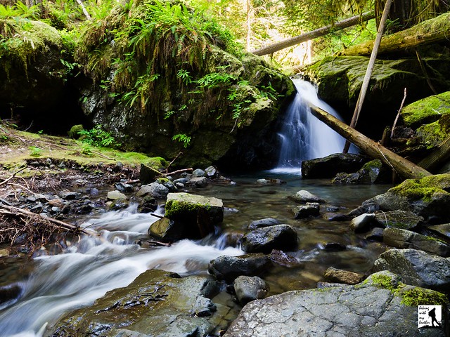
 Earlier this year we spent a weekend tromping around the Olympic Peninsula exploring a number of out-of-the-way hikes. One of our stops was Murhut Falls, a short jaunt out to a surprisingly impressive set of cascades tucked deep into a mossy ravine.
Murhut Falls is just one of quite a number of waterfalls along Murhut Creek, which flows down the flanks of Murhut Ridge. Despite a somewhat unusual name, we have yet to track down the story behind “murhut,” though we can find references to Murhut Creek as far back as the 1920s. Much of the area was logged around the turn of the last century, a legacy that can still be seen on the sawed-off stumps that linger along the trail to this day. Times have changed, and there are now efforts underway by conservationist groups to extend the protections of The Brothers Wilderness to Murhut Falls and parts of the trail.
 Some work has already gone into making Murhut Falls a little more accessible. The hike has always been a little off the beaten path, and likely because of that the trail to the falls had come degraded and somewhat treacherous. Thankfully, the trail was recently rehabilitated by the Forest Service, and the path and area around the base of the falls is in much better shape.
 From the trailhead, the route begins along a former logging road, rising gently through a young forest filled with rhododendrons. The wide, smoothly graded trail soon levels out and enters stands of old growth. Eventually the logging road ends and you will find yourself on proper trail hugging the mountainside and providing a few peeks at Mt. Jupiter and Jupiter Ridge. Before long, the trail abruptly turns and climbs into a steeply-walled ravine. Lush and mossy, the ravine feels close and remote, as if you’ve suddenly been transported deep into the wilderness. Continue to the end of the trail to find the two-tiered Murhut Falls tumbling down between two large pools. Find a good spot to enjoy the view or do a little exploring near the base of the falls.
With short mileage and little elevation gain, this hike is accessible for any hiker and a great choice for bringing along the youngsters. Perhaps because this hike is under two miles, it does not see a lot of foot traffic, which means you’re likely to enjoy the roaring waterfall without too much in the way of company. If you’re looking to add some mileage to your day, we recommend combining this with a trek out to Ranger Hole, another short hike located nearby. The falls are also fairly impressive for such a short hike. If this one isn’t on your list already, we recommend exploring this short hike next time you make the trek out to the Olympics.

To get there, take I-5 south through Tacoma to Exit 132B SR 16 toward Bremerton. Continue on SR 16 for 27 miles to merge with SR 3 North. Follow SR 3 to the Hood Canal Bridge, taking a left over the bridge onto State Route 104. Follow SR 104 as it merges onto US 101 and continue 25 miles through Quilcene to Duckabush Road (FR 2150). Turn right and follow the road 6.3 miles to FR 2530 signed Murhut Falls Trail. Turn right onto and continue 1.2 miles on the gravel road to the trailhead. -Nathan
Print Google Directions >>


0 Comments:
Post a Comment