


Total Ascent: 2200ft
Highest Point: 4600ft
Total Distance: 4.7 miles
Location: N 47° 16.9380, W 121° 10.6500
Required Permit: None.
Difficulty: Hard
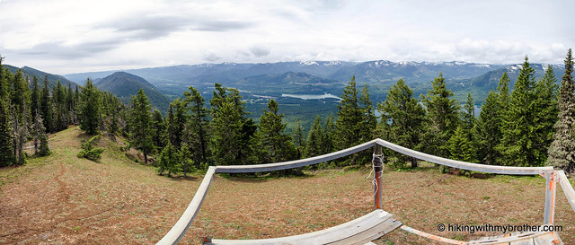
 Sometimes it seems that the more hiking we do, the more trails we discover. For all the trail miles we’ve put into the I-90 corridor, there are always more trails on our list to hike. Recently we had the chance explore Kachess Ridge, a somewhat lesser-known trail that scales one of the many ridges surrounding Lake Kachess.
 There's a lot more to Kachess Ridge Beacon, and you can learn all about it in our book, Hiking Through History Washington. You'll find a trail map, route descriptions, history, and more
 for this and many more hikes throughout the State. Help support hikingwithmybrother.com and the work we do by picking up a copy!
 To get there, take I-90 to Exit 70. Take a left over the freeway and turn left onto West Sparks Road. Continue for a half-mile to FR 4818 (signed Kachess Dam Road) and take a right. Follow FR 4818 for a mile to an unmarked road on the right. Follow this road for a half-mile to the small parking area at the trailhead. -Nathan
4 Comments:
Looks like another interesting and challenging trail. Like the history of the beacons. Hope to check out the trail in the future.
The trail looks amazing and one great challenge. I hope to enjoy this one with my buddies one of these days. I am sure they’ll appreciate this place.
Can it be done in winter?
Hi Pete,
The spring route won't be melted out until mid to late May. Hope that helps!
Jer
Post a Comment