Total Ascent: 2800ft
Highest Point: 4100ft
Total Distance: 12.5 miles
Location: N 47° 29.3580, W 121° 26.3120
Required Permit: Northwest Forest Pass
Difficulty: Hard
 Last year, on our hike out to Goldmyer Hot Springs, we passed by an intriguing side trail signed “Rock Creek.” We made a mental note of the rough-looking spur and with warming temperatures and the re-opening of the Dingford Creek Road we returned to investigate.
During the early 20th century, the Rock Creek Trail served as a link between the Snow Lake mining claims and the bustling timber industry of the Middle Fork Snoqualmie Valley. As the mines closed and the timber interests moved on, hikers and backpackers took their place. The Rock Creek Trail was once part of the Cascade Crest Trail, a regional predecessor of the Pacific Crest Trail (PCT). When PCT trailblazers blasted a more efficient route into the side of a mountain – now known as Kendall Katwalk – the Rock Creek route was largely abandoned. Today, the trail has become a road less traveled, with relatively few visitors every year.
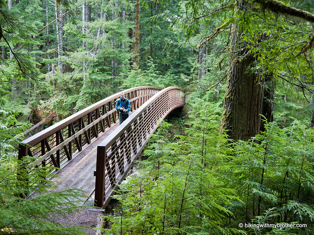
 From the Dingford Creek Trailhead, drop down and cross the Middle Fork Snoqualmie River, before joining up with the Middle Fork Trail. The trail follows the river through second growth forests with only a few short bursts of elevation. Cross Wildcat Creek and eventually join up with the old railroad grade which that will carry you almost all the way to Rock Creek. The grade over the creek washed out long ago, forcing a short detour downstream to cross the creek and rejoin the grade on the other side. Here, after three and a half miles, find the signed junction to the Rock Creek Trail 1013.1.
 The hike now begins in earnest. The trail is steep, rough, and rocky. It steadily climbs up the creek basin in a long series of tight switchbacks. As you gain elevation, you slowly enter old growth forest, complete with massive firs and hemlocks. Cross mossy talus fields while taking in views of Mt. Garfield’s sprawling granite faces. Hop across numerous streamlets that cut across your path as you continue your uphill battle into the Alpine Lakes Wilderness and eventually to the impressive Rock Creek Falls. Watch as waters flow out of Snow Lake and cascade almost 1200ft down to the basin.
Or, so we’re told. Our trek up to the falls was a bit premature, as deep snows forced us to turn back a half-mile from our destination. On the other hand, most hikers report that by the time full summer hits, the trail becomes a little overgrown, and often requires some bushwhacking to get to the falls. Either way, reaching one of the largest waterfalls in the Alpine Lakes Wilderness is going to take some effort. As for us, we’re planning on visiting Rock Creek Falls as part of a hike out to Gem Lake sometime in the coming months.
 This is not an easy hike, though it is a great alternative approach to Snow Lake that exchanges the crowds for an impressive waterfall. But this route doesn’t get a lot of traffic, and it shows – the trail is rough, narrow, and overgrown. You’ll definitely want to bring the gaiters and some hiking poles on this one. However, if solitude is what you’re after, this trail comes highly recommended.
To get there, take Exit 34 off I-90 and take a left on 468th Ave. Follow the road past the truck stop for about a half-mile until you reach SE Middle Fork Road, also known as Forest Road 56. Continue to follow the twists in the road until the pavement runs out. Continue on FR 56 for 12 miles, crossing the Taylor River. Once across, FR 56 veers to the right while the Taylor River Road continues another quarter mile to the Snoqualmie Lake Trailhead. Veer right and continue for about five miles to the Dingford Creek Trailhead. -Nathan


1 Comments:
Hello, you have nice blog =)
pls take a look mine its about hiking in Bosnia :)
http://www.premavrhu.blogspot.com/
Post a Comment