


Total Ascent: 2400ft
Highest Point: 3800ft
Total Distance: 10 miles
Location: N 47° 32.842, W 121° 22.958
Required Permit: Northwest Forest Pass
Difficulty: Moderate
 This week we returned to the Middle Fork Valley to take on a hike that has been on our list for years – Myrtle Lake via the Dingford Creek Trail. After our recent Rock Creek experience, we wanted to make sure we made it to our destination. We geared up for deep snow and headed up to the lake.
Myrtle Lake is the more popular of the trail’s two major destinations, the other being Hester Lake. Frequented mostly by backpackers and fishermen, the lakes don’t see a great deal of traffic. This is probably because, in addition to the trailhead’s relatively remote location, FR 56 is subject to intermittent-and-frequent-enough-to-frustrate closures at the Taylor River - which adds another ten miles to the hike. This portion of FR 56 is slated to close for repairs this summer. Maybe these will make the trailhead more accessible in years to come.
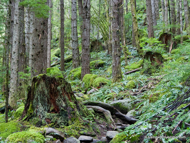
 The Dingford Creek Trail begins steeply, following Dingford Creek. The first mile is for the most part rocky switchbacks that eventually yield to a gentler grade upon entering the Alpine Lakes Wilderness. Here the second growth forest, replaced by older stands of fir and cedar, deepens, and begins to feel wilder. At three miles, the trail forks. The right branch leads out to Hester Lake, so continue to the left for Myrtle. Although we’ve not yet tried our hand at the Hester Lake Trail, it is reportedly rough as well as notoriously marshy.
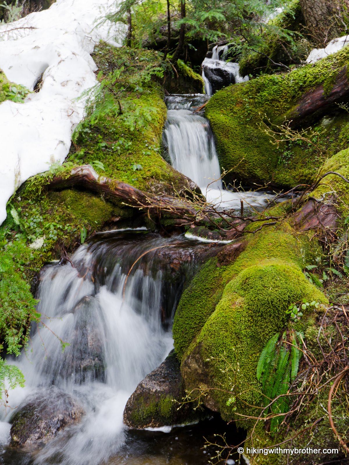
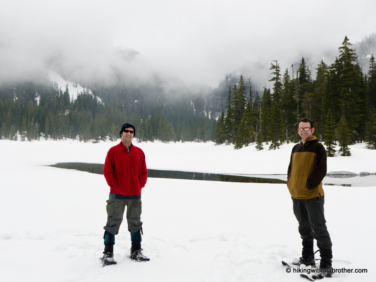
Past the junction, you’ll cross a couple of major streams flowing down from various small lakes tucked into the hills above the creek basin. The grade continues to ease as you approach Myrtle, eventually depositing you on the shores of the shallow lake. On a clear day, Big Snow Mountain looms above, an impressive backdrop to a typical alpine lake. There are a few comfortable camping sites here, making it an ideal base camp for exploring the sprawling lake country above.
If you’re one of those heading on to explore, a faint path continues along the lakeshore and switchbacks up for about a mile to Little Myrtle Lake. From here, there is cross-country access to the Arthurian-inspired Merlin, Le Fay and Nimue Lakes to the west, and to Big Snow Lake to the east. Or, you could just climb a little higher to a pass above Little Myrtle Lake to get some views of Lake Dorothy far below.
The snow made this hike a little more difficult for us than it would be after the melt. However, the trail more than makes up for it – rushing waters, open valleys, deep forests are all here. It’s easy to see why some hikers are so fond of this trail. With all the effort it takes to get to the lake,
 we recommend this more as an overnight than a day hike. After 18 miles of pot-holed forest road, and nearly 2400ft in elevation gain, there isn’t much energy left to explore all the other nearby hidden vistas and lakes. Save this one for your first backpack of the season.
To get there, take Exit 34 off I-90 and take a left on 468th Ave. Follow the road past the truck stop for about a half-mile until you reach SE Middle Fork Road, also known as Forest Road 56. Continue to follow the twists in the road until the pavement runs out. Continue on FR 56 for 12 miles, crossing the Taylor River. Once across, FR 56 veers to the right while the Taylor River Road continues another quarter mile to the Snoqualmie Lake Trailhead. Veer right and continue for about five miles to the Dingford Creek Trailhead. -Nathan
1 Comments:
Sounds like a very nice hike and a wonderful adventure. If you are willing to go a little farther abroad try Lake Ingalls up the Esmeralda Basin out of Cle Elem.
WWW.thecowswatching.blogspot.com
Post a Comment