


Total Ascent: 1350ft
Highest Point: 2450ft
Total Distance: 6.25 miles
Location: N 48° 3.8880, W 121° 45.9360
Required Permit: Northwest Forest Pass
Difficulty: Moderate
 This week we did the first of the many winter hikes we have planned along the Mountain Loop Highway. Although we've done some hikes along the MLH during the summer, snow-covered hikes in the area are new to us, so we decided to start with one of the most popular: Lake Twentytwo. Over 12,000 hikers a year make the trek up to the lake, many in the winter months. We packed up and headed out to join the ranks.
 Lake Twentytwo is drained by Twentytwo Creek, which flows down the mountainside to the South Fork Stillaguamish. “Twentytwo” is such an odd name, it begged for some explanation. One explanation is that in the late 1800s all the land in Washington State was surveyed and categorized into a grid system that assigned every square mile a numerical designation called a township section. We’re still using this grid system today. The “township section” the creek runs through happens to be 22, which appears on USGS maps of the area. However, there is another school of thought that suggests this creek was the 22nd on the long-gone Everett and Monte Cristo Railway, and this gave rise to the name. The area was surveyed in 1895 and the railroad company was formed in 1892, making it likely that the earlier railroad number may have informed the survey.
The railroad helped logging companies pull timber out of the area even faster than usual. Lake Twentytwo was already a popular recreation area early in the 20th century, sporting a YMCA camp by the 1930s. In 1947 roughly 800 acres around the lake were designated a Research Natural Area (RNA), preserving it from logging interests. Today, because of RNA protections, old growth western red cedar and western hemlock tower over hikers as they switchback their way to the lakeshore.
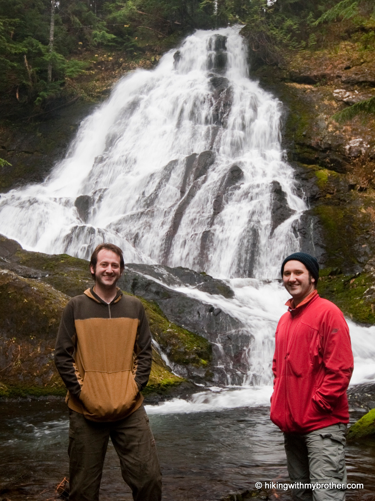
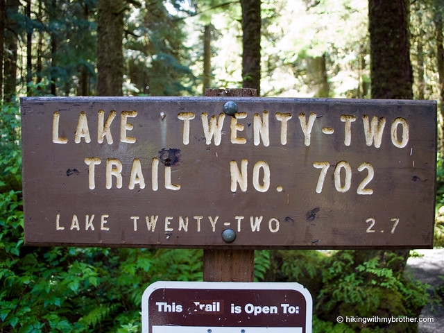
 The Lake Twentytwo Trail #702 begins slowly, wandering over streams through lush underbrush. Eventually the hike begins in earnest, becoming steeper and rockier. Most of the route follows Twentytwo Creek and more than a few impressive cascades. Use caution if you choose to follow a bootpath down to the creek to get a better view of a waterfall - they tend to be slick and unstable. Within the last ten years, the trail has been re-routed, extending some of the switchbacks to further ease the grade. Eventually, a talus field opens up the canopy for a view of the river valley below. Beyond the talus field, the trail plateaus in the final stretch to the lake.
Lake Twentytwo sits at the base of Mt. Pilchuck, fed by a half-dozen waterfalls cascading off the mountainside. In 2006, a trail around the trout-filled lake was completed, minimizing the impact of thousands of booted feet along the lakeshore. The area is prone to avalanches in late winter and early spring, so use caution during these times. Or, do what most folks do
 and find a spot near the lake’s outlet to enjoy the view.
This trail is a pleasure to hike. An undisturbed forest surrounds the route, making it feel more wild than other nearby hikes. Although often crowded in the summer, the trail makes for a great winter hike. You’ll undoubtedly still have some company, but it’s much easier to find your own little slice of the outdoors at this time of year. Despite over a thousand feet of elevation gain, the trek is manageable for almost anyone, making it a good choice for families and new hikers. If you haven’t made it out to Lake Twentytwo, this is an excellent time to check it out!
To get there, take I-5 North to Exit 194. Follow Highway 2 for about two miles. Stay in the left lane and merge onto Lake Stevens Highway 204. Follow for two miles to Highway 9. Take the left onto Highway 9 toward Lake Stevens. In just under two miles reach Highway 92 to Granite Falls. Take a right and follow for about nine miles to the Mountain Loop Highway. Follow the MLH for 13 miles to the trailhead on the right side of the road marked by a Forest Service sign reading "Lake 22 Trailhead." - Nathan
0 Comments:
Post a Comment