Total Ascent: 2200ft
Highest Point: 4413ft
Total Distance: 12.5 miles
Location: N 47° 22.0680, W 121° 34.1700
Required Permit: None
Difficulty: Moderate
 We’ve been avoiding Mt. Gardner for months. Each week as we thumbed through our hiking guide we’d quickly flip past it, opting instead for more appealing destinations. This week, the fates aligned such that we cracked open the page for Mt. Gardner and headed out to face our fears.
The route follows Forest Road 9020 as it slowly meanders its way up the side of Mt. Gardner to the end of the road a half-mile from the summit. From road’s end, a rough bootpath will guide you to the top. Although an easy hike is cheerfully outlined in guidebooks such as Day Hiking Snoqualmie Region: Cascade Foothills/I-90 Corridor/Alpine Lakes and 55 Hikes around Snoqualmie Pass, access has changed significantly, making it much longer and more of a slog than these publications suggest.
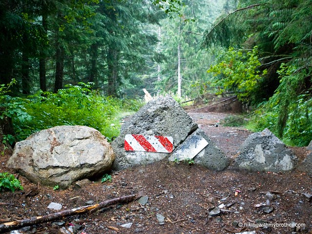
 In late 2007, in an attempt to better focus limited resources, the administrators of the Mt. Baker-Snoqualmie Forest decommissioned parts of FR 9020. This resulted in a semi-permanent roadblock just beyond the point that 9020 intersects with the McClellan Butte Trail – 3.5 miles shy of the starting point noted in many guidebooks. Beyond the roadblock, FR 9020 is no longer maintained and is washed out at both Alice Creek and Harris Creek. Alders and brush have already completely overgrown the trail, which is littered with blowdowns and debris. Clearly, the original roadwork was done with an eye toward expedience, as it evidently destabilized large sections of the slope, which has now slid – trees and all – into the road.
 As you gain elevation, respite from the tangled jungle of toppled trees and undergrowth is found in large talus fields that give increasingly long views of the Snoqualmie Valley. However, the proximity to the interstate translates into a startling amount of road noise. The views do not get much better beyond the talus fields, though there are some new vantage points.
We did not make it to the top – we turned back in frustration after admitting defeat in our protracted uphill battle against the trail. Rather than hack and slash our way back through the quagmire, we instead opted for the talus field taking us straight down the mountain to the much more hospitable Iron Horse Trail.
 We highly recommend you avoid this hike. Even when the road was in better shape, it was still a walk up an old Weyerhaeuser logging track, complete with recovering clear cuts, rotting stumps, and the inevitable flotsam and jetsam of 4x4 accessible backroads: shotgun shells and the sad, rusting remains of executed appliances.
If you really want to go there, take I-90 to Exit 38, then take a right and head past Olallie State Park and the access to Deception Crags for about two miles to reach FR 9020. Follow the progressively rougher logging road to the roadblock at 4.5 miles. Park and begin the trudge to the top. Or do an about-face and head up to McClellan instead – it’s a much better hike. - Nathan
Print Google Directions >>


1 Comments:
I'm glad you guys did that hike. Love to see reports of some of the "paths less travelled".
Post a Comment