


Total Ascent: 2000ft
Highest Point: 5168ft
Total Distance: 2.5miles
Location: N 47° 26.5740, W 121° 24.5460
Required Permit: Northwest Forest Pass
Difficulty: Hard
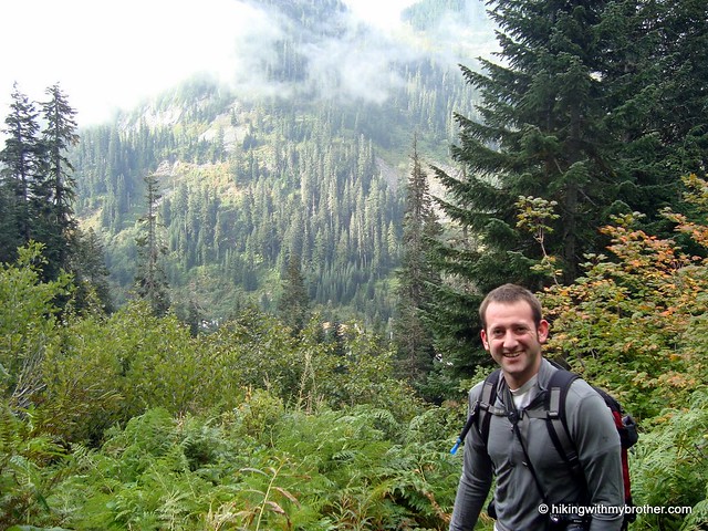
 After some time off, we decided we wanted a hike to shake out some of the cobwebs and get back into our hiking routine. Ever since we passed under it on our way to Kendall Katwalk, we’d been wanting to tackle Guye Peak. It only took a little bit of sunshine breaking through the overcast morning to send us out to Snoqualmie Pass to check it out.
 Tentatively named Slate Mountain for a time, Guye Peak was eventually named for F.M. Guye, who staked out a number of mining claims on both Guye Peak and Snoqualmie Mountain. Many of the rough paths the crisscross the mountains above Alpental have their origins in the mining activities of the late 1800s.
It’s something of an exaggeration to call the Cave Ridge Trail to the top of Guye Peak a “trail,” as it is more of a series of scrambles over boulders and fallen trees connected by short, boot-pounded paths though narrow bands of vegetation. Short and rough, the route aggressively attacks the elevation, conveying you up the slope with only an occasional begrudging switchback or two. At just over mile, things begin to level out and the trail passes by a seasonal pond before beginning the final push to the top.
Be aware that decades of use have resulted in many lesser-used side trails that can be confusing.
 While there is one sign directing you either to Snoqualmie Mountain or Guye Peak, the trail is unsigned. Dramatic overhangs and big drop-offs make this a popular hike with both hikers and mountaineers year-round. The short trail distance and close proximity to I-90 mean easy access, but can also lend an illusion of relative safety. Use caution near the top, as slick conditions can easily lead to a tumble or worse – quite a number of people have died on Guye Peak since the 1960’s.
Short and brutal, Guye Peak pays dividends in spectacular views. Survey the ski slopes of Alpental and Snoqualmie Pass as well as the whole of Commonwealth Basin. To the west lies Denny Mountain, supporting the slopes of Alpental
 and beginning a north running ridgeline that includes the Tooth, Bryant Peak and Chair Peak. Snoqualmie Mountain dominates the view to the north, while the Red Mountain steals the show as you swing east to take in Kendall Peak.
To get there, take I-90 to exit 52. From the exit, take a left onto Alpental Road for about two miles to a large gravel parking lot. The unmarked trailhead is across the road to the left. - Nathan
Print Google Directions >>
8 Comments:
Another awesome report -- I had no idea that hike was even there. Gotta try it (maybe next year)
Hi guys,
We have downloaded and used your GPX files several times and really appreciate the info! But now it is asking us to join Trimble Outdoors and pay a fee for your GPX files??? Is there a way around this? Thanks!
Hi W&T, no problem! There is now a link above the map called "Download GPX File", which should work! Some changes recently happened that make it no longer free to download our GPX files. We are in the process of making the hikes downloadable again from our site. Thanks for following and enjoy the hike!
Awesome!! Thank you so much. We are headed to Guye Peak tomorrow and really appreciate your GPX files. Thanks again.
Woody and Tanna
http://home.comcast.net/~weflybye/site/
Have fun and be safe in the snow!! :)
Thanks! Got all our safety and snow equipment on board.. hoping for some views!
Just a quick update on Guy Peak. We could not make the summit from this Summer route because of safety issues in the steep snow. But we did locate a Winter route GPX and had a successful summit yesterday under amazing blue skies and even more amazing views. If you ever want the Winter GPX just let us know and we will be happy to email it to you. Thanks again!
A small correction: "To the east lies Denny Mountain". This should be west :)
Cheers!
Post a Comment