about us | links | permit info
Subscribe to Hiking With My Brother Email Subscribe Follow Hiking With My Brother on Facebook Follow Hiking With My Brother on Twitter Hiking With My Brother Picasa Hiking With My Brother YouTube

Rattlesnake Ledge and Rattlesnake Mountain Trail

Our Hiking Time: 4h 30m
Total Ascent: 2600ft
Highest Point: 3500ft
Total Distance: 10 miles
Location: N 47° 27.5000, W 121° 48.3667
Required Permit: Discover Pass
Difficulty: Moderate

Nathan's PhotoThis week we had some unfinished business to attend to with the Rattlesnake Mountain Trail. Months ago, Rattlesnake Ledge was a good warm up during our Rainier training, but as the weather heated up, the amount of traffic increased exponentially. This created the difficulty of navigating between folks with large packs, which prompted us to forgo this hike in favor of the Cable Line. On one of our last climbs up to the Ledge we pushed past the crowds and further down the Rattlesnake Mountain Trail, quickly encountering icy snowpack that we were fairly unprepared to navigate. After meandering through trails and logging roads, rattlesnake mountain rattlesnake ledge hikingwithmybrotherwe were forced to turn around before reaching the next waypoint on the trail and assumed that we had somehow lost the trail.

We returned this week interested in finishing what we had started earlier in the year and shaking up our routine by doing a through-hike instead of a peak. We parked a car on the Snoqualmie Point end of the trail, and then carpooled up to the Rattlesnake Recreation Area to get started.

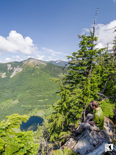
On the whole the trail is well maintained and friendly. The short two mile jaunt up to the Ledge makes it an attractive and easily accessible hike for families and large groups, which can quickly clog the sometimes narrow trail. The signed Ledge provides a fairly impressive panorama over Rattlesnake Lake, with Mt. Si, Mailbox Peak, and Mt. Washington dominating the view to the north. From here you can see two more outcroppings perched higher on the mountain which can be easily accessed by continuing up the trail. rattlesnake mountain rattlesnake ledge hikingwithmybrotherThe final ledge gives the greatest vantage point and most western view, with tiny trails carved into the scrub for the more adventurous scramblers to clamber around on.

The trail continues up through increasingly dense forest; at times sunlight is largely blocked out and footsteps lost in browned pine needless and the smell of humus. At about three miles, the trail begins to open up and intersect with a series of logging roads in various states of use and abandon. The trail is well signed and we had no trouble making our way to East Peak and its resident tower and vistas. The forest is young here, still not fully recovered from the timber harvest decades earlier. A mix of Noble firs and pines gives way to cedars and eventually alders, all no more than 30 years old. Trees continue to get younger as the trail progresses until you finally reach very recent cuts. Roughly the last two miles of the trail winds through recent select cut patches, with only a few trees left standing to foster an eventual rebirth.

rattlesnake mountain rattlesnake ledge hikingwithmybrotherEast Peak marks the end of the elevation gain at 3500’, and the rest of the trek was mostly a gentle downhill. Several other viewpoints await the hiker from here; Windy’s Point, Grand Prospect, and Stan’s Overlook are signed stopping points along the route to Snoqualmie Point, all offering expansive views to the north, eventually including views of Mr. Baker, Russian Butte and Mt. Teneriffe. Moderate in difficulty only because of the initial short bouts of steep grade going up to the ledge, this route is a great casual hike through the woods if you’re short on time but want to get some miles in.

From the number of hikers we passed coming from the opposite direction, Snoqualmie Point seems to be the more popular starting point of this trail; however, we’re recommending you start early at Rattlesnake Lake and avoid the crowds and the longer incline. Snoqualmie Point is easily accessed via Exit 27 off I-90 coming from the city. Take a right and follow the road for a ¼ mile until you hit the trailhead. Unfortunately there’s no onramp from Exit 27, so you’ll have to traverse North Bend to get back on I-90. To reach the Rattlesnake Recreation Area take Exit 32 off I-90 and a right on 436th Ave. SE. Follow the main road for a little over three miles before reaching the parking area. The trailhead begins on the opposite side of the lake, accessed via a service road opposite the lot. Park it and get going! - Nathan

Print Google Directions >>
Rattlesnake Mountain

Dirty Harry's Peak & Balcony

Our Hiking Time: 4h 30m
Total Ascent: 3400ft
Highest Point: 4680ft
Total Distance: 8 miles
Location: N 47° 27.0498, W 121° 37.2336
Required Permit: Discover Pass
Difficulty: Hard

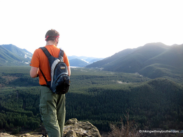
Nathan's PhotoOn the heels of our Mt. Washington hike, we decided to return to the Exit 38 area to explore a ridge on the opposite side of the I-90 corridor.  We had our sights set on an area unofficially known as Dirty Harry's Peak, which promised broad vistas and rusting artifacts from the area's logging past.

The roughness of the former logging road -- large rocks, often made slippery by water -- and uncompromising inclines after the Balcony makes this a difficult hike. dirty harrys peak dirty harrys balcony hikingwithmybrotherDefinitely attainable by most prepared hikers, just make sure to bring the hiking poles to steady you over water hazards and rock.  If the full trip up to the summit is more than you want to tackle, the hike up to the Balcony is a fine hike unto itself.  This hike is also less traveled than the more popular hikes nearby, which means you're likely to get these big views all to yourself.

There's a lot more to Dirty Harry's Peak, and you can learn all about it in our book, Hiking Through History Washington.  You'll find a trail map, route descriptions, history, and more for this and many more hikes throughout the State. Help support hikingwithmybrother.com and the work we do by picking up a copy!

To get there, take Exit 38 off I-90 and take a right. Follow the remnants of old US 10 for two miles past Olallie State Park and back under I-90.  Find the gate for the State Fire Training Academy warning you that it closes at 4pm. Park in the paved lot just outside the gates, as the Washington State Patrol which manages the Academy prefers hikers do not attempt to park on the shoulder near the trailhead.  From the lot, follow the road over a bridge for about three-quarters of a mile to a bend in the road.   The trail is on the right and is unmarked.  To find it, look for a trail flanked by a large concrete block.  -Nathan

Print Google Directions >>

Dirty Harry's Peak

Mt. Washington Trail

Our Hiking Time: 4h 15m
Total Ascent: 3400ft
Highest Point: 4420ft
Total Distance: 8.5 miles
Location: N 47° 25.5667, W 121° 42.0167
Required Permit: Discover Pass
Difficulty: Moderate

Nathan's PhotoStanding watch over I-90, Mt. Washington and Mailbox Peak are the gateway to Snoqualmie Pass. Here, the Issaquah Alps end and the Cascades begin. A hike to the top of Mt. Washington through a maze of forest roads can be a little disorienting, but the views are more than worth it.

Originally named Profile Mountain, Mt. Washington was renamed for a likeness of George Washington on one of the mountain’s many exposed rock walls. Extensively logged decades ago, the main route to the top is almost entirely logging roads in various states of decay. Over the years, multiple routes have been blazed to the mount washington hikingwithmybrothersummit which can make the hike a little confusing. Occasionally an unofficial-looking sign will point you in the right direction, though none of the trails on Mt. Washington are really considered “official.” This is probably because Mt. Washington is managed piecemeal by the Forest Service and Washington Parks and Recreation. Half the mountain is part of Iron Horse State Park and the other half is in Mount Baker-Snoqualmie National Forest. To further complicate matters, there is at least one large privately owned plot on Mt. Washington. In the end, this means that trail maintenance is left to independent trailblazers and trail stewards like the Washington Trails Association.

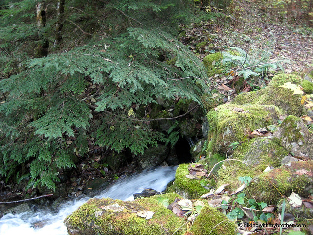
Finding the trail can be trickiest part of this hike, as it is unsigned. From the Upper Twin Falls Trailhead, take the spur up to Iron Horse Trail and head right. Keep an eye out for a small trail to your left, not more than a few hundred feet after you get on the Iron Horse. Depending on the time of year it can be a little overgrown. Once you find the trail and start up, the route becomes increasingly rocky, as it wanders through alder and maple, past streams and waterfalls. Before long you’ll encounter the first of many rock walls that attract the bouldering and climbing crowd. On summer days you’ll see climbers roped in and clambering up rock walls just off the trail.

mount washington hikingwithmybrotherThe first couple of miles of trail are the most difficult. Expect long and steady inclines. At two miles or so you’ll hit the Owl Hike Spot, a small viewpoint carved out of the trees opposite a sheer rock wall. Years ago, the Mountaineers had a number of Owl Hikes - short hikes close to the city that could be done after work and into the evening - though today this turnaround point seems to be the only lingering legacy of the Owl Hikes. The spot offers some good views of Rattlesnake Ledge, Cedar Butte and Rattlesnake Lake, and wall serves as a makeshift bench for taking it all in. From here on out the trail is pretty friendly, mild inclines intermingled with lengthy distances of level ground.

Eventually you’ll break out of the trees and into meadows revealing a spectacular view of Mt. Rainier presiding over the Cedar River Watershed. From the summit you can easily pick out Little Si, Mt. Si, Mt. Teneriffe and Green Mountain. Mailbox Peak to the immediate northeast, peeking out from behind another ridge of Mt. Washington. Soak up the view and enjoy.

mount washington hikingwithmybrotherThe is an engaging route. The trail regularly transforms itself from friendly ex-logging road - spacious, flat, and graveled - to intermittent streambed, complete with water-carved contours and exposed rock. It’s not a particularly easy hike, but the views are excellent. As an added bonus this trail is a little under the radar, so it makes a great alternative to Mailbox or Mt. Si on a summer weekend.

To get there, take I-90 to Exit 38 and head right. Almost immediately, take a right onto a gravel road to the Upper Twin Falls Trailhead. -Nathan

Print Google Directions >>
Mt. Washington
Copyright 2008-2016 - hikingwithmybrother.com
hikingwithmybrother@gmail.com