about us | links | permit info
Subscribe to Hiking With My Brother Email Subscribe Follow Hiking With My Brother on Facebook Follow Hiking With My Brother on Twitter Hiking With My Brother Picasa Hiking With My Brother YouTube

Grand Ridge Trail - High Point Trailhead

Our Hiking Time: 2h
Total Ascent: 900ft
Highest Point: 900ft
Total Distance: 5.25 miles
Location: N 47° 31.9140, W 121° 58.8540
Required Permit: None
Difficulty: Easy

Nathan's PhotoThis week we stumbled onto Grand Ridge, a portion of the Issaquah Highlands new to us. We’ve spent countless hours on Tiger Mountain never suspecting almost 10 miles of trail were hidden on the other side of I-90. When the morning brought more rain, we decided it was a good day for a short hike and headed out to Grand Ridge to see what we’d been missing.

grand ridge hikingwithmybrotherGrand Ridge is perhaps most famous for the coal mine that operated on and off from the early 1900s through the 1950s. The last of Issaquah’s mines to close down, the Grand Ridge mine was filled in and developers soon began to stake out claims. Fortunately, King County was able to work out a deal in the 1990s that set aside four acres of land for every one acre developed. This 4:1 plan eventually yielded 1,400 acres that became the home of the Grand Ridge Trail System, built largely by the Washington Trail Association.

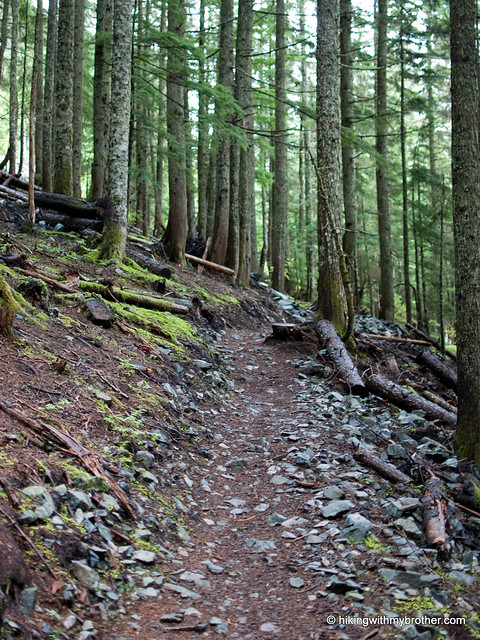
We started from the High Point Parking Area and followed the access road out to the High Point Trailhead, marked by a small trail map of Grand Ridge. Heading up from here will connect you to the short Coal Mine Loop that covers the lower section of Grand Ridge, and provides access to most of the trailheads in the area. Anyone who has spent time hiking around the Issaquah grand ridge hikingwithmybrotherAlps will feel right at home wandering through salal and sword fern. Although we chose not to head to the 1,422’ summit, it is accessible via an unmarked trail, which isn’t on King County’s map. Simply follow the Grand Ridge Trail toward the Mitchell Hill Connector Forest. Although there are no signs, this side trail is well-worn and should be obvious. If you hit the first log bridge, you’ve gone too far.

Grand Ridge is a great little alternative to the often-crowded Tiger Mountain. The surrounding forest is identical, though development occasionally intrudes into the forest scene. Like Tiger, the din of I-90 is almost inescapable, but it is nice to enjoy the mixed forest of maple and cedar without a lot of company. Check out Grand Ridge when you’re short on time and just want to take a walk in the woods without too much hassle.

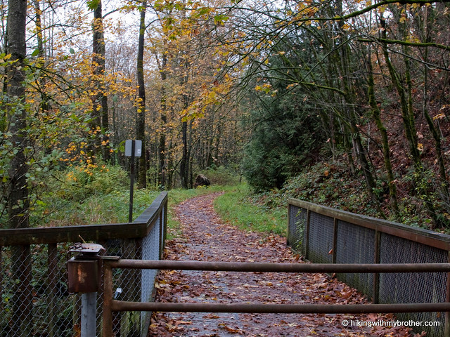
To get there, take I-90 to Exit 20, and turn left at bottom of ramp. Pass underneath I-90 and find a gravel lot on the left just past the on-ramp. Park and follow the Issaquah–Preston rail trail to the trailhead. -Nathan
Grand Ridge - Highpoint Trailhead

Mt. Kent via McClellan Butte Trail #1015

Our Hiking Time: 5h 30m
Total Ascent: 2800ft
Highest Point: 5087ft
Total Distance: 7 miles
Location: N 47° 23' 23.4240, W 121° 37.0620
Required Permit: None
Difficulty: Hard

Nathan's PhotoWe were going over our maps looking for potential hikes when we turned up a route to the top of the Mt. Kent. Digging deeper, we found that very few hikers had made the trek to Mt. Kent’s often-overlooked summit. Sensing a challenge, we picked out our route and set out for the trail the following weekend.

Living in the shadow of McClellan Butte, Mt. Kent has never drawn a crowd. The first recorded ascent was April 10, 1938 by a group of Mountaineers, probably looking for something a little different after duke duchess of kent hikingwithmybrotherclimbing McClellan Butte dozens of times. Unfortunately, little else is written about this lonely peak. We’d welcome any local lore anyone has to share.

A little over half the route to Mt. Kent follows the McClellan Butte Trail #1015. This section is easy to follow and, while a bit challenging, does not pose any real difficulty. However, once you leave the McClellan Trail, route-finding and bushwhacking are the name of the game.

The fun begins just as the McClellan Trail plateaus and starts to lead you around the back of the mountain. Your first glimpses of Chester Morse Lake signal your imminent departure from maintained trails. A short push through the trees leads to a large talus field. Follow the ridgeline connecting McClellan Butte and Mt. Kent. Below you may see a forest road; however, this road is located within the Cedar River Watershed and is closed to public access.

mtkent hikingwithmybrotherClimb down the talus field and stay on the east side of a large ridge as you head toward Alice Lakes. From the Alice Lakes basin, find the path of least resistance up through talus fields, patches of mountain blueberry, and the occasional hemlock sapling. Climbing out of the cirque encompassing Alice Lakes is tough. A few sections are steep enough to properly be called a scramble – you’ll probably be forced to use your hands a few times on the way up.

Emerging from the trees to the summit reveals a decent view of McClellan Butte and the Duke and Duchess flanking the Alice Creek Basin. On a good day, Mt. Rainier will rise proudly over Chester Morse Lake . . . of course, we didn’t get to see any of that. Low clouds heavy with rain made it impossible to see anything at all. So we settled down for a soggy lunch and signed the summit register.

Despite the rain, this was an enjoyable hike that we’d recommend to those that like a challenge. Be prepared to do some stomping through vegetation and to use your route-finding skills. Because footpaths are faint at best, often disappearing into themt kent alice lakes hikingwithmybrother underbrush, a GPS will make this hike more manageable. Alice Lakes feel secluded and remote, and we never encountered another soul once we left the McClellan Trail. All in all, a nice little escape.

A number of sources warn of the high avalanche risks on both McClellan Butte and Mt. Kent. The talus slope above Alice Lakes is extremely steep and avalanche prone. Use caution when hiking these areas.

To get there, take I-90 to Exit 38, then take a right and head past Olallie State Park and the access to Deception Crags for about two miles to reach FR 9020. Follow the progressively rougher logging road to the roadblock at 4.5 miles. -Nathan

Print Google Directions >>

Mt. Kent

Anniversary Post: Celebrating Two Years

Nathan's PhotoIt’s hard to believe it was just two years ago that hikingwithmybrother.com was launched. What began as two brothers tracking their hikes has slowly morphed into something of an online hiking guide for local hikers. We’re happy that so many hikers have been able to use the information they find on hikingwithmybrother.com to plan their trips.

We’ve been a lot of places over the last 12 months. We’ve tromped through a great deal the Middle Fork Snoqualmie River Valley. We broke out of the I-90 corridor and explored the North Fork Snoqualmie River and several hikes on Highway 2. We’ve been to the top of lofty peaks, at the shores of alpine lakes, and have slogged down trails more stream than earth and done far more than our fair share of bushwhacking--all to bring you back the most up-to-date route descriptions and trail conditions.

Although this second year found us on trails that led to more adventure and more secluded destinations, it was really defined by a single overarching theme: rain. Much more than our first year, the rainy season began early and stayed late. Snow lingered until late June, and it seemed that almost every hike forced us to break out the rain gear. It was a tough year for hiking.

Beyond the rain and the adventure, perhaps our most exciting development this year was the launch of the hikingwithmybrother app. If you haven’t downloaded this yet, take a minute to check it out – the scaled down version of the blog lets you find a nearby hike with a tap of a screen. It’s a great resource when hiking plans need to change at the last minute.

We’re looking forward to our next year, and we’ve got some great hikes planned. You’ll see us up in the Mountain Loop Highway, spending trail miles on Highway 2, and exploring remote sections of the popular Mt. Si Natural Resource Conservation Area and the West Tiger Mountain Natural Resource Conservation Area. We also have some big trips planned, like a summit of Mt. Adams and a multi-night tour of the Enchantments.

We hope you’ve enjoyed our first two years. We hope you’ll stick with us for the many good hikes to come. Thanks for your support, and we’ll see you on the trail.

-Nathan & Jer
Copyright 2008-2016 - hikingwithmybrother.com
hikingwithmybrother@gmail.com