


Total Ascent: 800ft
Highest Point: 4300ft
Total Distance: 5.9 miles
Location: N 47° 57.550, W 120° 2.660
Required Permit: None
Difficulty: Moderate
 Last summer we spent a weekend hiking and exploring the ridges surrounding Lake Chelan. Our tour included everything from creekside trail and windswept mountaintops to quiet state park walks. One of our stops was to the Outback Trail on Echo Ridge, a popular winter recreation area that offers big views of Lake Chelan and the surrounding landscape.
Developed in 1988, the Echo Ridge Nordic Ski Area is part of the Okanogan-Wenatchee National Forest but is largely maintained and managed by the Lake Chelan Nordic Ski Club. During the winter months, there’s opportunity for cross-country skiing, snowmobiling and snowshoeing along roughly 25 miles of looping trails, much of which is groomed. During the summer months, the area attracts bikers, hikers and equestrians.

Follow the road as it traverses back toward the lake and ends in about a half-mile. From here, follow the rough and rocky bootpath another .4 miles up the ridgeline to the top. The best views of the hike are along this .4-mile climb to the top. Here you can pick out the snowcapped Enchantment Range, nearby Goat Mountain and Lake Chelan. The summit itself is situated in a grassy meadow largely surrounded by pines. Once you reach the summit rocks, make sure to take a look around for a geocache and add your name to the list. Once you’ve had your fill head back down to the main road and head right to complete the loop and return to the trailhead.

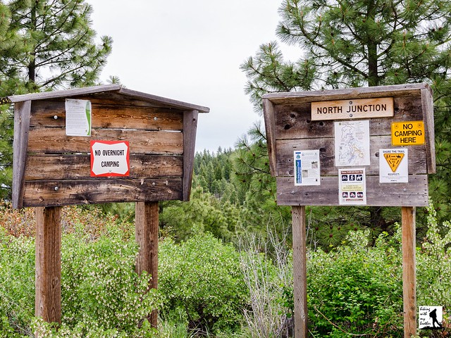
To get there, take I-90 to Exit 85 to Cle Elum/Leavenworth. Cross the freeway and head right on WA 970 toward Leavenworth as it merges into WA 97. As WA 97 ends, merge onto US 2 toward Wenatchee following signs for US 2 and WA 97. In West Wenatchee, follow signs for WA 97 ALT. Once on WA 97 ALT, continue 33.7 miles to Woodin Ave, taking a left into Chelan. Once across the bridge take a left onto N Columbia Street, then another left onto State Route 150. Follow State Route 150 for 1.8 miles to Boyd Road. Veer right onto Boyd Road and follow for 2.6 miles to a split, where you'll stay left on Boyd Road for another 1.8 miles to reach Cooper Gulch Road. Keep right on Cooper Gulch Road for 2.9 miles to a T-intersection. Turn right onto FR 8021 and continue 2.5 miles to the North Junction Trailhead. -Nathan
Print Google Directions >>
0 Comments:
Post a Comment