about us | links | permit info
Subscribe to Hiking With My Brother Email Subscribe Follow Hiking With My Brother on Facebook Follow Hiking With My Brother on Twitter Hiking With My Brother Picasa Hiking With My Brother YouTube

Horseshoe Mine

Our Hiking Time: 3h 30m
Total Ascent: 2000ft
Highest Point: 2800ft
Total Distance: 5.6 miles
Location: N 47° 28.253,  W 121° 37.702
Required Permit: None
Difficulty: Hard (due to route finding)

Nathan's PhotoPlease note that Middle Fork Road is in the process of being paved. It may be that access to this trail is limited during construction.

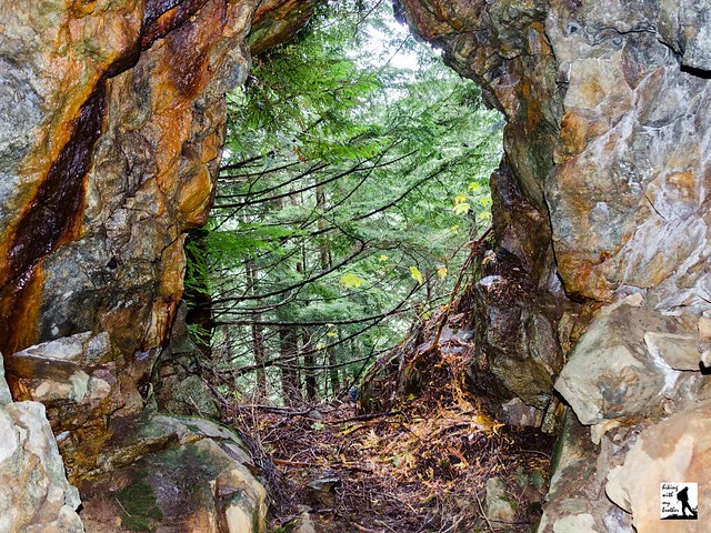
A few weeks ago we decided to head back to the Middle Fork Snoqualmie Area to do a little more exploring. After doing a bit of research we found a few references to a copper mine that had been carved into the slopes of Mailbox Peak above Granite Creek near the Granite Lake Trail. We’ve made the hike out to Granite Lakes in the past, so we decided to try an alternative approach for this trek up to the seldom visited Horseshoe Mine.

The Horse Shoe Mining Company was established in Seattle in 1904 and eventually held 11 claims covering 220 acres of land in the Middle Fork Snoqualmie and Pratt River Valleys. The company joined other mining operations already working along Quartz Creek and in the Dutch Miller area. One of the company’s first claims was known as “Horse Shoe” and was centered around a four-foot wide vein of bornite ore. From this vein, now known as the Horseshoe Mine, miners used hand drills to follow the bornite a few hundred feet into Mailbox Peak. The bornite was then hauled out of the river valley to be smelted down for its copper. Sometime before 1909 the bornite ran out and the company abandoned the claim. Today, the remains of the mine slumber in the forests above Granite Creek.

The trail begins directly off the Middle Fork Road, following the remains of an old logging road into a young forest of alder and hemlock. The road is currently marked by a large notice indicating a trailhead, parking area and restroom will be built here soon, making it likely that this approach will be developed in the near future. Continue following the road for .6 miles to a well-marked bootpath leading up and into the trees on your left. From here the thin trail is a little rough, but easy to follow as it works its way up the mountainside. Keep an eye out for the mossy stumps with springboard notches cut into them, a lasting reminder of the area’s timber history.

After a half-mile of climbing through encroaching underbrush the path connects with the Granite Lakes Trail. Head left and continue to climb alongside the sound of Granite Creek to the 2.3 mile mark. Look for a slight dip in the trail indicating an overgrown forest road that once provided easy access across the creek. The trail is otherwise unmarked and it will require a little bushwhacking to find a way across. The barely recognizable remains of the bridge that once spanned the creek are still here and can be used, though nearby rocks and logs may prove easier to navigate. Once on the other side the wide roadbed is easy to find and is marked by the rusting remains of a 1941 Chevrolet Special Deluxe Coupe.

Continue following the road as it begins its gentle climb toward the mine. Find a trail leading steeply up the hillside in about a third of a mile, though the road continues on for a few hundred feet. The path is a helpful start, but it soon disappears leaving you with few hints as to the location of the mine. From here, traverse the mountainside in the same direction as the road bed below, continuing to climb upward. Within .1 mile you should reach what remains of a rough road, which eventually leads to the mine. Note that there are few discernible landmarks in this area and it took us quite a while to find the mine without GPS data. If at all possible, bring along a GPS with our tracks as it will make it much easier to reach your destination.

We don’t recommend this hike for everyone, as some route finding skills are required to find your way to the mine. However, if you’re comfortable with a little adventure, this is a fun alternative to the Mailbox Peak crowds. If you’re looking for a longer hike, you can get some more mileage by starting from the Granite Lakes Trailhead rather than the shortcut we recommend here. As always, use caution around the mine as it could be unstable.

To get there, take I-90 to exit 34 and take a left onto 468th Ave. Follow the road past the truck stop for about a half-mile until you reach SE Middle Fork Road, also known as Forest Road 56. Turn right and follow the road for a few twists and turns, keeping left when the road splits. After 2.2 miles reach SE Dorothy Lake Road. Turn left and continue 2.9 miles to a pullout on the right side of the road just before the bridge crossing the Middle Fork Snoqualmie. Park here and walk a few hundred feet down to the abandoned road to begin the trail. -Nathan

Print Google Directions >>

Horseshoe Mine

Coal Creek Trail - Red Town Trailhead

Our Hiking Time: 1h 45m
Total Ascent: 500ft Out
Highest Point: 650ft
Total Distance: 5.6 miles
Location: N 47° 32.694, W 122° 09.098
Required Permit: None
Difficulty: Easy

Nathan's Photo
With winter now in full swing and the snow beginning to creep down from the mountaintops, our hiking destinations are largely confined to lower elevations. Not long ago we found time to explore Coal Creek Park, an urban greenway that connects Cougar Mountain to Lake Washington. Accessible year-round and steeped in the mining history of the area, this rail-to-trail hike makes for excellent winter hiking.

Coal Creek Park’s friendly greenery gives little indication that nearly all the landscape along the trail has been altered and reshaped by mining activity. Back in 1863, coal was discovered along Coal Creek and over the next 100 years, miners would pull 11 million tons of coal from the slopes of Cougar Mountain before the mines were sealed in 1963. All that coal prompted folks to dub the area "Newcastle Hills," after England's coal-rich city of Newcastle. In 1870, Newcastle Hills coal drove the creation of Seattle's first railroad, the Seattle & Walla Walla, which hauled coal from Cougar Mountain out to Elliot Bay. At that time, horses pulled coal cars along the track down to Lake Washington and a series of barges shuttled to coal out to Elliot Bay to be shipped down to San Francisco. Over time, waste rock from the mining process built up, and much of it was used for fill or piled up near the rail line. Today, most of Coal Creek Park travels through the forests that grew over these piles of waste rock.

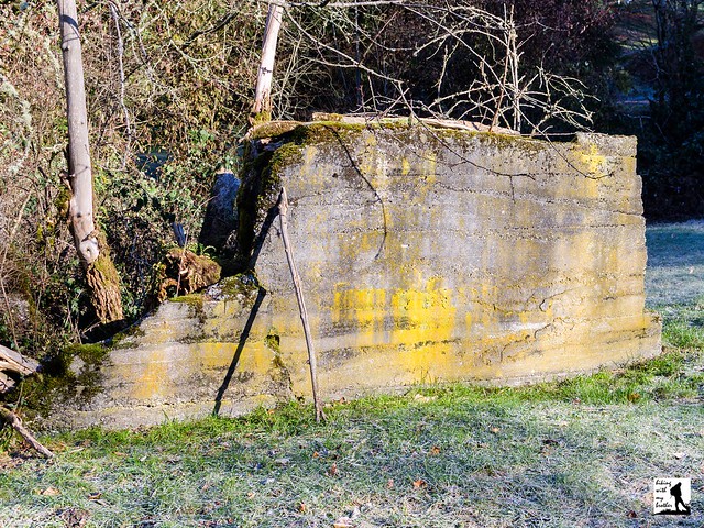
The trail begins from the Red Town Trailhead, named for the mining settlement of Red Town that was built in this area. The name was a reference to the red paint that was used on most of the buildings. From the trailhead, cross Lakemont Boulevard to a grassy meadow, following a wide trail toward the sound of a splashing creek. Note the concrete foundation here, which is all that remains of the former Coal Creek Hotel (later known as the Newcastle Hotel). The trail quickly descends past a mine shaft and down to Coal Creek and the old railroad grade. After .25 miles you’ll reach North Creek Falls, a small but pleasant waterfall that flows year-round. As you leave the waterfall, keep an eye on the creek as you will soon see the water flowing over wooden boards. These boards are all that remain of the wooden box that miners built to enclose the creek and build tracks over it.

As you push onward through a forest of alder and Douglas fir, watch for other remnants of the mining past peeking out from beneath a sea of sword fern. At around the .5 mile pass a concrete platform on your left that is the remains of a locomotive turntable. Soon find yourself climbing an elaborate series of wooden bridges and steps before reaching a mining road at the .7 mile mark. Head right and downhill, following the road for another half-mile to a junction with the Primrose Trail, named for the former Primrose Mine. We recommend taking a right and following this trail as it descends deeper into the valley and passes Sandstone Falls in a few tenths of a mile. Continue following the Primrose Trail until it reconnects with the Coal Creek Trail. From here you can head back to the Red Town Trailhead via the Coal Creek Trail to make something of a loop, or continue almost another mile out to the Coal Creek Trailhead where a fish ladder can be found complete with a viewing area. Either way, enjoy this unexpectedly quiet walk through a young forest.

To get there, take I-90 to Exit 13. Head right up the hill on Lakemont Boulevard just over three miles. Look for the entrance to the Red Town Trailhead on the left side of the road. - Nathan

Print Google Directions >>

Coal Creek Trail

Echo Ridge - Outback Trail

Our Hiking Time: 2h 30m
Total Ascent: 800ft
Highest Point: 4300ft
Total Distance: 5.9 miles
Location: N 47° 57.550, W 120° 2.660
Required Permit: None
Difficulty: Moderate

Nathan's PhotoLast summer we spent a weekend hiking and exploring the ridges surrounding Lake Chelan. Our tour included everything from creekside trail and windswept mountaintops to quiet state park walks. One of our stops was to the Outback Trail on Echo Ridge, a popular winter recreation area that offers big views of Lake Chelan and the surrounding landscape.

Developed in 1988, the Echo Ridge Nordic Ski Area is part of the Okanogan-Wenatchee National Forest but is largely maintained and managed by the Lake Chelan Nordic Ski Club. During the winter months, there’s opportunity for cross-country skiing, snowmobiling and snowshoeing along roughly 25 miles of looping trails, much of which is groomed. During the summer months, the area attracts bikers, hikers and equestrians.

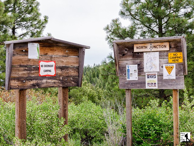
The Outback Trail begins from the signed North Junction Trailhead, following a forest road toward the heights of Echo Ridge. The area is mostly scrubland, punctuated by small pines and scotch broom, with wildflowers during the spring and early summer. After a flat .6 miles of hiking the trail splits into a loop, and while either direction will get you where you’re going, we recommend heading left for an easy stroll out to your first views of the lake and valley below. As you continue onward, the route heads behind the ridge and temporarily leaves the views behind as it begins to gently climb up through an increasingly rocky landscape. At 2 miles from the trailhead you’ll arrive at the spur road to the summit.

Follow the road as it traverses back toward the lake and ends in about a half-mile. From here, follow the rough and rocky bootpath another .4 miles up the ridgeline to the top. The best views of the hike are along this .4-mile climb to the top. Here you can pick out the snowcapped Enchantment Range, nearby Goat Mountain and Lake Chelan. The summit itself is situated in a grassy meadow largely surrounded by pines. Once you reach the summit rocks, make sure to take a look around for a geocache and add your name to the list. Once you’ve had your fill head back down to the main road and head right to complete the loop and return to the trailhead.

Echo Ridge is well worth a visit any time of year, though it does shine during the winter months. The easy access to higher elevations means that snowshoers are likely to find sunny, snowy views on their visit, especially along the Outback Trail. All of the trails are easy or moderate, which makes Echo Ridge an ideal destination for almost any hiker. Note that if downhill skiing is more your speed, the Echo Valley Ski Area is located at the base of Echo Ridge.

To get there, take I-90 to Exit 85 to Cle Elum/Leavenworth. Cross the freeway and head right on WA 970 toward Leavenworth as it merges into WA 97. As WA 97 ends, merge onto US 2 toward Wenatchee following signs for US 2 and WA 97. In West Wenatchee, follow signs for WA 97 ALT. Once on WA 97 ALT, continue 33.7 miles to Woodin Ave, taking a left into Chelan. Once across the bridge take a left onto N Columbia Street, then another left onto State Route 150. Follow State Route 150 for 1.8 miles to Boyd Road. Veer right onto Boyd Road and follow for 2.6 miles to a split, where you'll stay left on Boyd Road for another 1.8 miles to reach Cooper Gulch Road. Keep right on Cooper Gulch Road for 2.9 miles to a T-intersection. Turn right onto FR 8021 and continue 2.5 miles to the North Junction Trailhead. -Nathan


Print Google Directions >>

Echo Ridge
Copyright 2008-2016 - hikingwithmybrother.com
hikingwithmybrother@gmail.com