Total Ascent: 3800ft
Highest Point: 5400ft
Total Distance: 7.4 miles
Location: N 46° 58.2483, W 121° 54.1433
Required Permit: National Park Pass
Difficulty: Hard
 Not long ago we ventured back to the Carbon River area to hike some of the oldest sections of trail in Mt. Rainier National Park on our way up to the summit of Florence Peak. The trek promised big views of Mr. Rainier and a hike through a lush temperate rain forest. As we soon discovered, the West Boundary Trail delivered all this and more.
The West Boundary Trail is a remnant of the Boundary Trail that once circled the park, allowing rangers to patrol the park’s boundaries. In 1933 a division of the Civilian Conservation Corps known as the Emergency Conservation Corps established a camp at Isput Creek to make improvements to the Carbon River Road.
 In addition to work on the road, the Corps also built and improved many trails in the park, including the Boundary Trail. Over the next 40 years, the park boundaries changed as did the need to patrol the park boundaries on foot, and by the 1970s the Forest Service stopped maintaining the trail. While remote sections of the trail are now lost beneath the advancing forest, some portions were never truly abandoned by hikers, including what is now known as the West Boundary Trail. After the most recent washout of the Carbon River Road, the Washington Trails Association and other volunteer groups worked tirelessly to expand and reclaim this historical trail. Today, thanks to their efforts, the hike from the Carbon River Entrance up to Alki Crest is once again easily accessible.
The trail begins from the former Carbon River Ranger Station along Rain Forest Loop Trail. The short interpretive trail wanders under the forest canopy over a series of wooden boardwalks and low bridges. Connect with the signed West Boundary Trail at the far end of the loop as it begins to veer uphill. From the junction, the route begins a series of steep switchbacks through old growth forest, punctuated by brief plateaus that draw you southwest along the shoulders of Sweet Peak. At 1.2 miles at the end of a switchback a short side trail provides access to a cascade sometimes referred to as the West Boundary Trail Falls. Take a moment to catch your breath and take in the mossy waterfall before continuing ever upward.
As you press on, the trail almost immediately crosses the creek and provides glimpses of the upper reaches of the waterfall before beginning a set of tight switchbacks alongside the creek. After about a half mile of climbing, the trail veers away from the creek and rises steeply up to the ridgeline of Alki Crest and a trail junction. From here the West Boundary Trail continues on, and the approach up to Florence Peak is less well maintained. To continue your ascent, follow the bootpath heading southeast along the ridge, catching glimpses of the surrounding landscape through the thinning trees.
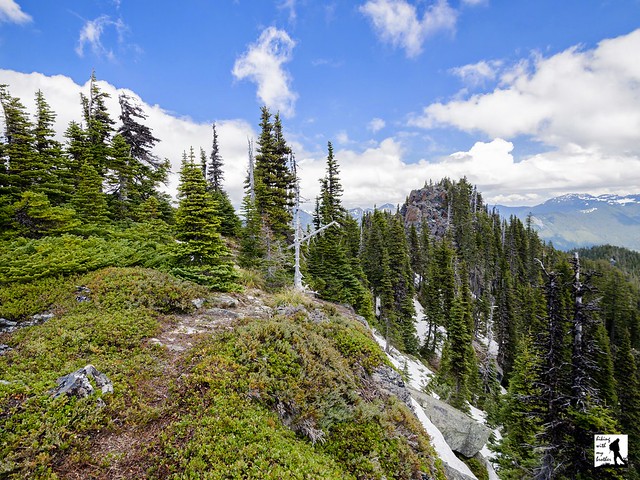
As you near the summit, the trail becomes something of a scramble through meadows and rocky outcroppings. Eventually find yourself clambering up onto exposed rock and what looks to be the summit. Technically, the true summit is further on, though that scramble is somewhat more treacherous. Wherever you decide to stop, Mt. Rainier looms large to the south. Tolmie and Howard Peak can be seen in front of Rainier as you begin to turn east. Arthur Peak is the closest peak to the east. To the north you can pick out Bearhead Mountain and Old Baldy. Settle in and break out a map to see how many more mountaintops you can identify.
With a lot of elevation to tackle and short sections to scramble, this can be a challenging hike. Likely because of the challenge, it does not see a great deal of traffic. While the views are excellent, they are rivaled by a trek through mossy forest and tumbling waterfalls. Tough but beautiful, this is hike is a good alternative to Green Lake and other popular hikes further down the Carbon River Road.
 To get there, take I-5 South to I-405. From I-405 take SR 167 south toward Auburn. In 20 miles take the SR 410 Exit toward Sumner/Yakima. Follow SR 410 for 12 miles to SR 165. Take a right and continue on SR 165 for about 10 miles through Wilkeson and Carbonado to the Carbon River Road/Mowich Lake Road junction. Veer left onto the Carbon River Road and follow for 7.7 miles to the Carbon River Entrance of Mt. Rainer and parking. -Nathan
Print Google Directions >>


