Total Ascent: 150ft
Highest Point: 300ft
Total Distance: 1.8 miles
Location: N 47° 40.458, W 122° 59.790
Required Permit: None
Difficulty: Easy
 A few months ago we headed out to the Olympic Peninsula to find hikes that could be done during any season. One of those hikes was Ranger Hole, a short forest hike to the Duckabush River through lush forest and over 100 years of history.
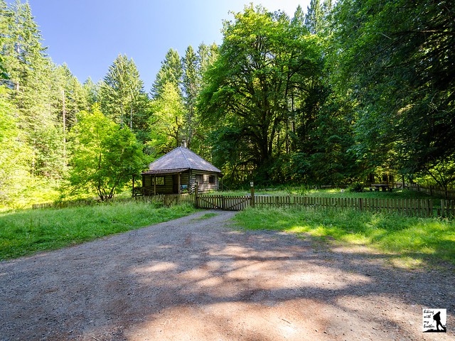
Back around the turn of the last century, the forests of the Olympic Peninsula were known as the Olympic National Reserve. In 1907, the Forest Service was reorganized and the Olympic National Forest was born. The newly created National Forest needed an administrative headquarters, and Assistant Forest Ranger Emery J. Finch was chosen to build it. Ranger Finch began construction of “No. 27 Interrorem Administrative Site” in 1907 and moved into the cabin with his new bride in April of 1908. While intended to be temporary, the name “Interrorem” stuck and, although Ranger Finch resigned in 1910, the Interrorem Ranger Station served as the main administrative building for the Olympic National Forest and the Mount Olympus National Monument for the next 25 years. In 1933, the Mt. Jupiter Fire Lookout was built, the cabin was re-purposed as a fireguard station, and the administrative functions were moved elsewhere.
 The cabin, now known as Interrorem Guard Station, served as basecamp for activities organized under the Emergency Relief Act, which would become the Works Progress Administration. Workers participating in Depression Era programs such as the Civilian Conservation Corps were stationed on the acreage surrounding the cabin. Interrorem Guard Station then operated solely as a fireguard station from 1942 to 1986, when modernizations in fire detection made the fireguards no longer necessary. While occasionally used by volunteers after 1986, the cabin quickly fell into disrepair until 1994, when it was renovated and made available to the public for overnight rentals. In 2013, the Interrorem Guard Station was added to the National Register of Historic Places as the oldest Forest Service building in the Olympic National Forest and one of the oldest in the Pacific Northwest region.
The Ranger Hole Trail #824 begins from the Interrorem Guard Station, passing into a mixed second growth forest. The trail likely follows the same route the rangers used to access the Duckabush River over the years. Although the waters are currently closed to fishing, the trail leads out to a once-ideal fishing hole used by the rangers, which is where the trail gets its name. The fern-lined trail gently meanders under hemlock and alder, almost immediately offering a side trip along the Interrorem Nature Trail. This short trail is full of interpretive signs that provide additional background on rustic cabin life before reconnecting with the Ranger Hole Trail.
Push onward up a small rise before gently descending to the river. You’ll hear the river long before you see it, as the water crashes through a narrow canyon a few dozen feet below the end of the trail. Use caution in this area: the cliff drops off abruptly. Access to the fabled fishing hole can be difficult, as it requires a short scramble down the rocks to the riverside. Take a few moments to enjoy the river before heading back to the cabin.
This short little trail, accessible throughout the year, works as a great winter hiking option. With very little elevation gain and short distance, hikers of all ages can tackle this hike. While the hike is probably too short to justify a trek out to the Peninsula, it can easily be combined with the Duckabush River Trail or Murhut Falls. Consider taking this stroll through history the next time you head out to Hood Canal.
To get there, take I-5 south through Tacoma to Exit 132B SR 16 toward Bremerton. Continue on SR 16 for 27 miles to merge with SR 3 North. Follow SR 3 to the Hood Canal Bridge, taking a left over the bridge onto State Route 104. Follow SR 104 as it merges onto US 101 and continue 25 miles through Quilcene to Duckabush Road (FR 2150). Turn right and follow the road 3.7 miles to the end of the pavement. The cabin and trailhead are on the left. -Nathan
Print Google Directions >>


0 Comments:
Post a Comment