


Total Ascent: 1700ft
Highest Point: 5300ft
Total Distance: 4.0 miles
Location: N 47° 46.1580, W 121° 3.0180
Required Permit: None
Difficulty: Moderate
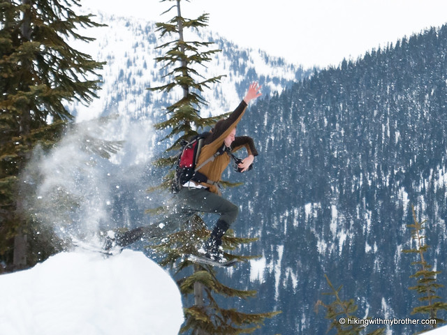
 We managed to work in a short snowshoe a few weeks ago, taking advantage of some decent weather to explore portions of the old Yodelin Ski Area near Stevens Pass. We were aiming for a lonely prominence above the Ski Area unofficially named Welldiggers Ass, where we had heard we could find some decent views. Although trail information was a little sparse, we plugged the coordinates into our GPS and headed out to see what we could find.
The Yodelin Ski Area opened for business on December 27, 1969. At the time, Yodelin boasted a three-story lodge, a single rope tow, and a 1,800-foot double chairlift. Owned by Nason Properties, the operation also worked to develop over 180 homesites into “Yodelin Village” across the highway from the ski area. During 1970, a number of lodges and cabins were built, and the venture appeared off to a good start. However, on January 24, 1971, a large avalanche crushed two cabins, killing four and hitting the resort with over $2,000,000 in legal claims. Despite continued warnings from the State of Washington of how avalanche-prone the area was, Nason Properties continued to develop and expand the Yodelin Ski Area. In 1972, an additional 1,600-foot chairlift was installed, but the expansion only helped the Ski Area to limp along for another few years. By 1976, the Stevens Pass Ski Area bought what remained of Yodelin, including a chairlift, which is still in operation as the Tye-Mill lift. The remaining lift was moved to Crystal Mountain where it serves as the Upper Cambell lift.
 The trail begins from the old Yodelin parking lot, now usually referred to as the overflow lot for Stevens Pass. The route initially follows the remains of the roads used by the defunct ski area, before quickly switchbacking up the mountainside. You will quickly find expansive views of the surrounding landscape as you wind your way up Yodelin’s former slopes. Along the way, keep an eye out for another artifact of the area’s past: the concrete foundations that once supported the ski lifts still trace a route up the mountain.
 Once you reach the ridgeline, steer east toward a burned out swath of forest to reach Welldiggers Ass. Slog your way up through a maze of bleach-white tree trunks and into the forest, pushing past the true summit to a viewpoint further east. The views are not stunning, but you should be able to pick out nearby Jim Hill Mountain, Arrowhead Mountain and the Chiwaukums. If you are thirsty for a little more distance, retrace your path and head to the flat-topped highpoint at the southern end of the ridge, known as Point 5023.
 Short, sweet and easily accessible, this little snowshoe is perfect if you are short on time or want to add a couple extra miles to your day. As an added bonus, the slopes do not see a lot of foot traffic these days. Backcountry skiers occasionally make their way over from the Steven’s Pass Ski Area, but most do not make it all the way up to Welldiggers Ass, so expect a little solitude at the top.
 To get there, take US 2 to Stevens Pass. Continue another mile and a half past the main ski area to an overflow parking lot on the right. Once parking for Yodelin, the Stevens Pass area now owns the lodge here. Park and find the route beginning behind the lodge. -Nathan
Print Google Directions >>
0 Comments:
Post a Comment