


Total Ascent: 700ft
Highest Point: 1560ft
Total Distance: 8.2 miles
Location: N 48° 13.1220, W 121° 46.7100
Required Permit: None
Difficulty: Easy
 This week, we were looking for a gentle hike that would not be too taxing on my still-recovering foot. After some research we settled on a fairly popular riverside hike in the Darrington area: the Boulder River Trail.
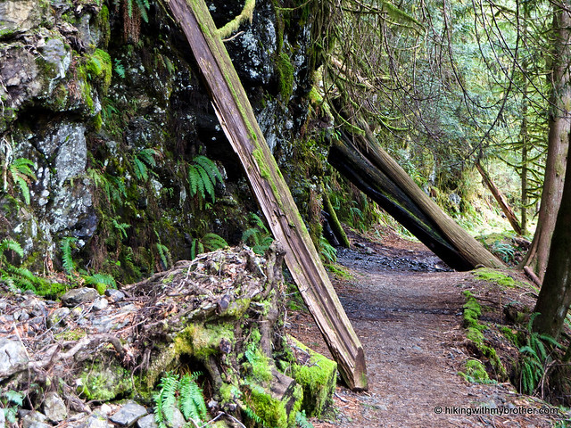
It’s unsurprising that the Boulder River Trail is a popular hike. This trail gently takes you through a dramatic and impressive landscape. Once beyond Feature Show Falls, the forest becomes moss-laden and heavy, losing much of the undergrowth prominent in the early portions of the trail. The river
 remains a nearly constant companion, always within hearing distance even as it slips from view. Creeks cut across the trail, winding down to the river in contrast to the more dramatic cascades on the opposite bank. Even the wildlife was unexpected: water ouzels, wood ducks and hummingbirds all made an appearance. With only a few hundred feet of elevation gain and worthy destinations early-on, this trail is an excellent way to give children or the reluctant hiker a taste of the wilderness. One caution: when we hiked this trail, there were a couple of significant blowdowns that were a little tricky to navigate. Most hikers shouldn’t have much of a problem with these.
There's a lot more to Boulder River, and you can learn all about it in our book, Hiking Through History Washington. You'll find a trail map, route descriptions, history, and more
 for this and many more hikes throughout the State. Help support hikingwithmybrother.com and the work we do by picking up a copy!
 To get there, take I-5 north to Exit 208 and drive east on SR 530 for about 19 miles to milepost 41. Immediately after the milepost, turn right onto FR #2010 – some maps call this French Creek Road, but it’s not well signed. Follow the unpaved road almost four miles to its end and the trailhead. -Nathan
Print Google Directions >>
7 Comments:
I love reading about your hikes and seeing the great pics! Thanks!
I took my Sister and BIL on this hike while they were up from San Diego and we all had a great time.
We arrived at the trailhead about 11am and by 12:30 we were eating lunch at the first waterfalls. The hike down to the river is a wee bit tricky but well worth it for the views up and down the river. My 17yo son was climbing over all the boulders like a mountain goat.
After lunch we proceeded up to the 2nd falls, maneuvering over a large log that is blocking the trail. Our hike ended at the 2nd waterfall.
We thoroughly enjoyed this hike and I am looking forward to getting out again soon.
Once again we enjoyed one of your suggested hikes. We didn't hike the entire trail, although I'd like to sometime. But Feature Show Falls was quite lovely...especially on the beautiful Saturday that we had this weekend. I love this site. Thank you so much.
Here are my photos: http://alaskagirlatheart.com/2012/03/25/feature-show-falls/
I'm glad you found an alternative to Barclay Lake and got to enjoy some nice weather! Thanks for sharing the link!
Have hiked this trail many times...you have some great photos. Not sure if you've notice, but looking at the large falls shot, (as if you're going back down the trail), can you see the face in the mossy rocks? rebecca
This hike was beautiful up to the 3rd waterfall - the biggest. Anticlimactic if you go to the end - the best parts were in the first half. And this is not an 'easy' hike - would label it medium - especially if it's wet and muddy ;)
We absolutely agree with you Jonathan and Cheri, after real highlight of this hike is that last waterfall - it doesn't get much better than that. Continuing on to the river is a nice walk in the woods, but definitely a little anticlimactic after the waterfalls!
Post a Comment