Our Hiking Time: 4h 20m
Total Ascent: 2200ft
Highest Point: 5324ft
Total Distance: 5.2 miles
Location: N 48° 3.4740, W 121° 47.8680
Required Permit: Northwest Forest Pass
Difficulty: Hard
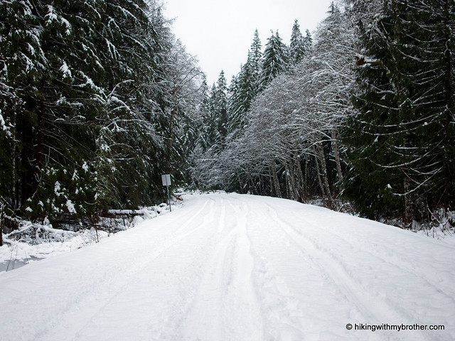
This week we topped off a month of Mountain Loop Highway destinations with a classic, Mt. Pilchuck. For years, readers have been telling us about the views from Mt. Pilchuck’s popular summit. Despite the deepening snow, the first sunny morning in weeks found us heading toward Mt. Pilchuck State Park.
In the summer, hikers flock to Pilchuck – with such stunning views at the end of a fairly short trail, it’s easy to see why. We had some company on our snowshoe to the top, but this was nothing compared the crowds you’ll navigate on a July weekend. We highly recommend trying this in the early winter, when the snow is clean and powdery, and the wind has sculpted the trees to look like something out of a children’s book. However, use caution in the winter months. The route is marked, but it occasionally skirts avalanche chutes, and the mountain has plenty of abrupt cliffs that can sneak up on the unwitting snowshoer. Snow also makes parking at the trailhead nearly impossible – simply go as far along Mt. Pilchuck Road as your vehicle can, and hike the remaining miles to the trailhead.
There's a lot more to Mount Pilchuck, and you can learn all about it in our book, Hiking Through History Washington. You'll find a trail map, route descriptions, history, and more for this and many more hikes throughout the State. Help support hikingwithmybrother.com and the work we do by picking up a copy!
To get there, take I-5 North to Exit 194. Follow Highway 2 for about two miles. Stay in the left lane and merge onto Lake Stevens Highway 204. Follow for two miles to Highway 9. Take the left onto Highway 9 toward Lake Stevens. In just under two miles, reach Highway 92 to Granite Falls. Take a right and follow for about nine miles to the Mountain Loop Highway (MLH). Follow the MLH for 12 miles to Mount Pilchuck Road, just over the bridge crossing the South Fork Stillaguamish River. Follow the forest road seven miles to the trailhead. - Nathan
Print Google Directions >>
Big Four Ice Caves Trail #723
Our Hiking Time: 3h
Total Ascent: 300ft
Highest Point: 2000ft
Total Distance: 2.5 miles (7.5 miles in winter)
Location: N 48° 3.1980, W 121° 31' 31.1760
Required Permit: Northwest Forest Pass
Difficulty: Easy
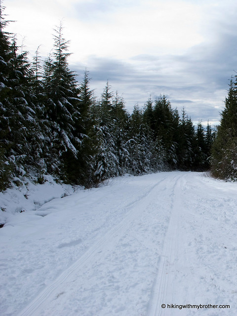
Our Mountain Loop Highway tour continued this week with a trip out to the Big Four Ice Caves. For generations, the Caves have drawn crowds out to the Stillaguamish Valley, and we wanted to find out why. When downed trees and snow-covered roads stopped us short of the trailhead, we were undeterred; we happily hiked the extra miles through the falling snow to catch a glimpse of the Caves at the base of Big Four Mountain.
Named for a “4” shaped snowfield on the east face of the mountain, Big Four Mountain rises abruptly from the landscape, creating steep-sided recesses that harbor permanent snowfields. When snowmelt flows down the mountain and under the snowfield each year, caves are craved out by the rushing water. While these caves look solid and stable, there is always a chance of avalanche or cave-in. Use caution around the Caves, and resist the temptation to explore interiors or climb the snowfield above them.
While the Caves are currently popular with hikers, back in the day the area was a resort destination. In 1921, Big Four Inn was opened by the Rucker brothers, owners of the railroad that pumped vast amounts of timber out of the valley to the expanding cities along the Puget Sound. Thousands of tourists were carted out to the inn by rail year-round for a weekend in the wilderness, enjoying staggering views of Big Four Mountain, playing a round of golf, or taking a short hike up to the Ice Caves. After a brief heyday, the resort fell on hard times with the removal of the rail line in 1936 to make way for the Mountain Loop Highway. It limped along until 1949 when it burned to the ground, and today, all that remains are the remnants of the inn’s chimney still standing in the Big Four picnic area.
Despite the demise of the resort, the Big Four Ice Caves Trail #723 still sees over 50,000 hikers a year. Comprised almost entirely of bridges, boardwalks, and staircases, the short trail is an easy walk, gaining less than 300ft in elevation. Such a mild route makes this trail ideal for everyone in the family or an introduction to snowshoeing. During the winter, the Mountain Loop Highway closes, and this hike begins at the Deer Creek Snow play area. This adds a few miles of easy, snowy road-walking. Our hike was made more difficult by a recent storm that toppled more than a few large trees, forcing a couple of significant detours. Until more snow falls to cover up these new obstacles, the trail will be a tricky snowshoe – you may need to step out of your snowshoes to navigate around some of the blow-downs.
To get there, take I-5 North to Exit 194. Follow Highway 2 for about two miles. Stay in the left lane and merge onto Lake Stevens Highway 204. Follow for two miles to Highway 9. Take the left onto Highway 9 toward Lake Stevens. In just under two miles, you’ll reach Highway 92 to Granite Falls. Take a right and follow for about nine miles to the Mountain Loop Highway. Take the MLH for a little over 25 miles to the Big Four Picnic Area. – Nathan
hikingwithmybrother.com partners with The Seattle Times!
Good news! We are now partnering with the Seattle Times to share all the great things we do here at hikingwithmybrother.com. We hope that we can help the Times have the most up to date hiking information possible, as well as supporting any hiking features they might have in the future.
Check it out!
Subscribe to:
Posts (Atom)