


Total Ascent: 2500ft
Highest Point: 5608ft
Total Distance: 4.5 miles
Location: N 47° 26.3400, W 121° 26.6400
Required Permit: Northwest Forest Pass
Difficulty: Hard
 At some point, after doing a number of hikes nearby, we decided that we’d looked at Denny Mountain’s mile-long ridgeline enough times to warrant an excursion to the top. Despite some cloudy weather, we headed out to Alpental to tackle the steep slopes and check out the summit before the ski season set in and closed the mountain to hiking.
 There is some argument over which member of early Seattle’s Denny family the mountain was named after. Most assume everything “Denny” is named after Arthur Denny, though his brother David spent considerable time in Snoqualmie Pass staking mining claims. Whichever Denny it was, since 1968 most people know the mountain slopes as the Alpental Ski Area. Famous for very steep and very challenging runs, Alpental was a destination for wintertime thrill-seekers from the moment it opened.
Unsurprisingly, Denny Mountain is much less famous for hiking. Equally unsurprising, there is no real trail to the top of Denny Mountain. Occasionally a trail will be hacked through a particularly dense patch of huckleberry, but mostly the uphill trudge is an exercise in finding the path of least resistance. Ski slopes are less friendly when the snows disappear. Rocks and shrubs cover the mountainside, and resorts tend to leave things wherever they happen to fall, knowing that snows will obscure old boards, pieces of concrete and derelict construction equipment. The evidence of decades of skiing make most of the lower mountain less pleasant to hike through.
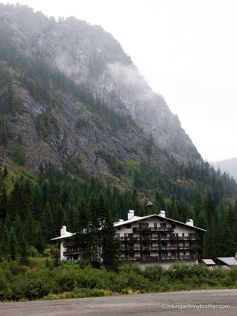
 We followed the Armstrong Express chairlift up through the clouds to the base of the upper mountain. Although mostly successful with route finding, we still found ourselves neck-deep in bramble or backsliding on a loose patch of scree. While challenging, the first half of the hike is manageable without too much trouble. The upper mountain is an entirely different story. Be prepared for an all out bushwhack up gullies and small cliffs. Small hemlocks and huckleberries served as much needed handholds as we slowly worked our way up the mountainside. Thankfully, a few short plateaus give some relief from the slog.
Attaining the true summit can be slightly tricky, as it requires wiggling through narrow opening between the rocks. Once through enjoy the views of Snoqualmie Mountain and Guye Peak. And, if you’re lucky enough to make the climb on a less cloudy day, your 5,522’ perch should provide some excellent views of the Snoqualmie Valley and Mt. Rainier. Ignore the weather instrumentation and savor the rewards of a difficult hike.
This hike is probably better done in snowshoes, as the snow will smooth out most of the rougher aspects of the hike. If, like us, you enjoy the adventure and extra challenge, Denny Mountain certainly has more
 than enough of both to satisfy most hikers. Aside from those gluttons of punishment however, Denny Mountain is a difficult hike to recommend to anyone else. Somewhere on the slopes of the upper mountain the amount of effort the hike demands surpasses the reward. If you’re looking for a rigorous hike and some views, Snoqualmie Mountain is a much better choice.
To get there, take I-90 to exit 52. From the exit, take a left onto Alpental Road for about two miles to a large gravel parking lot. The unmarked trailhead is across the road to the left. -Nathan
2 Comments:
Wow, 4.5 miles in 6.5 hours is slow going indeed. Thanks for trying it so we don't have to.
For those wanting bigger payoff for tussling with ski slopes, I suppose there's always Crystal Mountain. The restaurant at the top of the lifts operates for weekend brunch during the summer, but you're almost right on Mt. Rainier at that point so it's also a perfect place for a picnic lunch. And there's a frisbee golf course along the trail on the way back down. Quite the civilized opposite of your bushwhacking journey.
That sounds much better! Thanks for the tip!
Post a Comment