


Total Ascent: 2700ft
Highest Point: 5174ft
Total Distance: 4 miles
Location: N 47° 22.4160, W 121° 29.7300
Required Permit: None
Difficulty: Hard
 After weeks of ponds, lakes, and creeks, the snow has retreated enough to make some shorter peaks pleasantly accessible. The moment the weather cleared up enough for some good views we packed up and headed out to a non-descript mountain along the I-90 corridor: Humpback Mountain. The talus-covered climb had been on our list since we visited Annette Lake and it was well worth the wait.
As one might expect, Humpback’s shape – a smoothly curving ridgeline arching up one side of
 the mountain and down the other – inspired the Mountaineers to christen it “Humpback,” probably in reference to the whale. The mountain sits between two long abandoned railroad stations, Bandera and Rockdale. The old railroad grade still runs along Humpbacks slopes, today carrying hikers and bikers along the Iron Horse Trail.
There is no officially maintained trail up Humpback Mountain, but there is a well-worn and easily followed path kept up by a few dedicated volunteers. However, finding the trailhead is the most confusing part of this hike. First, there is more than one way to access the trail. You can take one of two roads off Forest Service Road 5510. Each has its own advantages. The higher road, obviously, cuts out some elevation but takes a mile to intersect with the trail. We took the lower road, which gets you off the logging road and onto the trail in a half-mile. Second, after you decide your approach, there are no helpful signs or rock cairns to guide you to the trailhead, you just need to keep an eye out for tags or a clear indication to turn up the ridge.
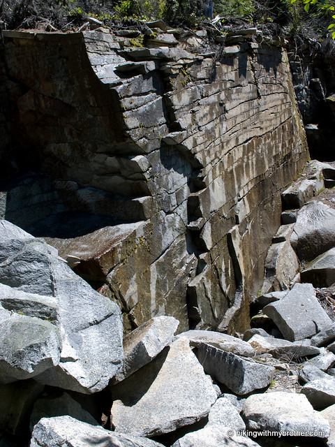
 Whichever way you choose, the workout begins once you find the trail. Expect a straightforward approach with little in the way of switchbacks. Climb though a young forest of hemlock and fir and into older growth. As you near the top, a few plateaus temper the upward march before the trees thin and talus begins. Navigating the rocks and boulders can be difficult if you allow yourself to get distracted by glimpses of the views that wait at the top. On a good day, the landscape stretches out from Humpback’s rocky summit in every direction. To the north, across I-90 are Granite and Bandera with the distinctive tooth of Kaleetan Peak rising behind. Immediately the east, Silver Peak and Abiel Peak surround Annette Lake and take up most of the skyline. To the south, a vast sea of forest stretches to the base of Rainier. Humpback’s western neighbor, Little St. Helens sits above the Snoqualmie Valley and the interstate leading back toward the city.
Short, intense and rewarding. We enjoyed this hike, though it’s not for everyone. The steep and relentless grade makes it a training hike, but not ideal for a causal walk in the woods. Still, it is a short amount of distance to get views normally reserved for much longer hikes. If the hike is too short for your taste, you can extend the hike down the other side of
 Humpback to Scout Lake, though we understand the trail down to the lake is something of a scramble. Humpback Mountain is also not as well known as other nearby hikes, so it is also a great alternative on those crowded sunny days.
To get there, take Exit 47 off I-90 and take a right over the bridge. At the intersection, turn right onto Tinkham Road (aka Forest Road 55). Continue on the gravel road for just over a mile to a fork. Veer left onto the Hansen Creek Road (aka Forest Road 5510) and continue one-and-a-half miles, under an old railroad trestle to the first trailhead - marked by large boulders blocking a forest road. From here, you have a choice. You can park at this bend and follow the unmarked road, or you can continue up for another half-mile to a locked gate and another left branching logging road. Both options intersect with the Humpback Mountain trail. Find a space to park and hit the trail. -Nathan
Print Google Directions >>
5 Comments:
I just hiked this today. Amazing trail. Probably the best I have been to up in the I-90 area,
You start up a very steep trail hiking the ridge in dense tree growth until the trees thin out into massive old-growth conifers and large boulders. Follow the trail over some large rock formations to the summit.
HARD TO FIND - Go underneath the rail road bridge and up past the first switchback to a locked gate on the left hand side of the road. Follow the trail past the gate until the trail makes it's first abrupt right about .5 miles in. The trail is on the right in a bend of soft, light-colored dirt.
Amazing Hike! just did it yesterday. On a beautiful Saturday I was the only one on the trail. I think it may even be steeper than mailbox, but not as many roots to trip over. The peak just now has some snow so it can make the bouldering a little treacherous.
If you don't mind, please post the GPX link for this. I think I'll give it a try soon. BTW, do you know how this road is in the winter? Can you get to the spot where your track begins by car?
We'll get the GPX soon. Probably going to be touch to get to your car up the forest road this time of year. They don't clear this road and the snow is pretty thick already.
I enjoyed this hike yesterday. Thanks for posting the information. I don't think I would have found the trail without your description and the GPX to confirm. One thing I will add is that if you're going this time of year, it is steep and the pine needles falling on the trail make it pretty slippery coming down...not that I would know from personal experience or anything.
Post a Comment