Total Ascent: 5600ft
Highest Point: 8365ft
Total Distance: 10.6 miles
Location: N 46° 7.8397, W 122° 10.2888
Required Permit: Northwest Forest Pass; Climbing Permit
Difficulty: Hard
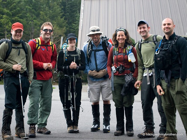
 Just a few weeks after we climbed off the summit of Mt. Rainier, we had planned to take on another large peak and penciled it for sometime this summer. For the last several months, as we’ve sat down to plan out our hikes, the details slowly fell into place – we reconnected with some of the folks we climbed Rainier with, picked out our mountain, and did all the necessary paperwork to find ourselves in the Marble Mountain Sno-Park near the base of Mt. St. Helens at five am on a cloudy Monday morning. Lingering snows kept the more popular Climbers Bivouac route officially closed; we instead chose to follow the Worm Flows route to the summit, so named for the rivers of rocky lava that the path traverses.
Known in native languages as Louwala-Clough or “smoking mountain”,
 Mt. St. Helens was named in 1792 by explorer George Vancouver to honor Alleyne Fitzherbert the Baron St. Helens. Over the last 400 years, many small eruptions have been recorded, some fitfully coughing up ash and smoke and often leaking the chunky silica-heavy lava that built up the Worm Flows. These hiccups pale in comparison to the well-known eruption of May 18th, 1980. Twenty seconds after 8:32am, an earthquake destabilized the bulging north face of the mountain, triggering the largest debris avalanche in recorded history. As 1.7 cubic miles of rock and mud shifted downward, it explosively released titanic geologic pressures at near-supersonic speeds sending ash and debris 80,000ft into the atmosphere. When the dust settled, 24 megatons of thermal energy had been expended, millions of tons of rock and ash had been displaced, and Mt. St. Helens was 1,313ft shorter.
Beginning at the Marble Mountain Sno-Park at 2700ft, the Worm Flows route follows cross-country ski routes through still-recovering forests of Douglas fir rising out of the ash amongst bleached stumps and fallen logs. The fairly level path is lined with underbrush of huckleberry and mountain blueberry that quickly gives way to bear grass and wildflowers as the forest cedes ground to rockier terrain. At two miles the trail breaks away from the forest at Chocolate Falls, a small 40ft fall along Swift Creek. At this point the trail becomes more serious, making the falls an ideal place to change out gear and take a break before fording the creek and continuing up the mountain in earnest.
 From here, the route enters an increasingly barren landscape of mudflows and rock. Large posts and occasional cairns built precariously atop boulders of sharp andicite mark the way. Navigate through the jumbled lava flows past observation stations the 4600’ marker barring those without climbing permits. Depending on the weather, as you push beyond the cloud level, Mt. Adams begins to grow on the horizon while Mt. Hood rises to the south. Ahead a false summit beckons with promises of a shorter hike. Ash and loose gravel become more prevalent as you climb, making it not only more difficult for boots to find firm purchase, but in the right conditions wind can kick up clouds of choking dust. The option for switching to the snow helps alleviate these problems, and, depending on the conditions, crampons might also be helpful as you rest-step your way toward the top.
The trail deposits you on the rim of a crescent-shaped crater framing a dramatic view of Spirit Lake and Mt. Rainier. Below, in the bottom of the caldera, the lava dome burps clouds of steam and sulfur into the air. For the adventurous, continue west along the rim to the true summit, which requires something of a descent before trudging back up to find a rough mound of rocks piled up at the 8365’ point. Take in the expansive views, absorb firsthand how much of the mountain is truly gone, then gear up for the descent. With snow present year-round, some controlled glissades down the steep slopes will save both time and your
 knees, not to mention all the fun you’ll have on the way.
While this route is a bit challenging, it is a non-technical climb. Experienced and prepared hikers should not have too much difficulty attaining St. Helens’ heights. The alien and engaging landscape created by this active stratovolcano vies for attention against an abundance of great views of the surrounding environs, making the trip well worth the effort. Worm Flows is also a nice introduction to hiking larger summits, and the exposure to climbing steep snow fields and negotiation of glaciers make this a great training hike for an ascent of Mt. Rainier.
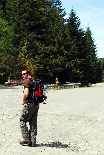
To get there take I-5 to Exit 22, Dike Access Road. Head right under the freeway keeping right to merge onto Old Pacific Highway, then staying right to merge onto E Scott Ave before connecting with WA-503 also known as Lewis River Road. Continue on WA-503 into the shadow of St. Helens, taking a left onto Forest Road 81 toward the Ape Caves. Veer right on Forest Road 83 toward Marble Mountain Sno-Park and find the trailhead in the parking lot. - Nathan
Print Google Directions >>