Our Hiking Time: 1h 20m
Total Ascent: 200ft
Highest Point: 2560ft
Total Distance: 2 miles
Location: N 47° 25.4760, W 121° 26.0100
Required Permit: Northwest Forest Pass
Difficulty: Easy
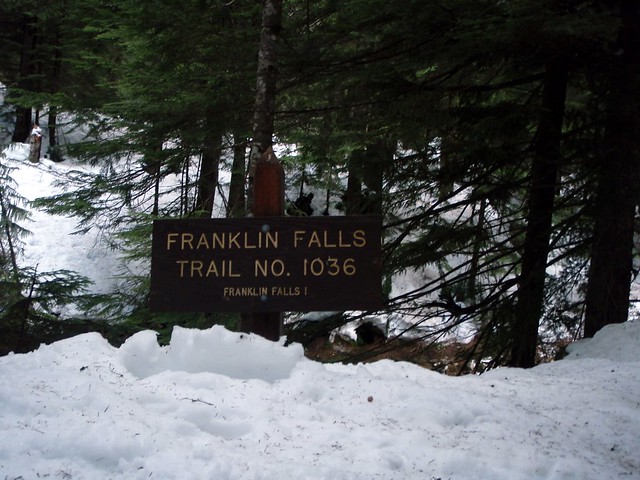
One of the best times to re-discover a hike is during the winter; the crusty snow and low temperatures work to transform a mundane stroll into an exciting exploration. Such was the case with Franklin Falls. While we’d made the mile-long trek from the parking lot to the waterfall a number of times in the past, it had always in the heat of summer alongside many other hikers. This was an opportunity to experience the trail in a whole new light.
Franklin Falls Trail No. 1036 hugs the bank of South Fork Snoqualmie River as it winds beneath a thick canopy of cedar and pine. Early on the trail, you’ll wander past a few summer homes and short spur trails that wind down to access the creek. As you gain some elevation, the din of I-90 will occasionally rise above the babble of the creek, but this is soon replaced by the roar of the falls themselves.
At about 1/4 mile we found the trail washed out and were forced to take a bit of a detour around the mess. Regaining the trail, we enjoyed the views of the icy creek below, having few problems with the footing until we were almost within sight of the falls. Slick snow banks necessitated using our hiking poles to make sure we didn’t slip and take a dunk in the creek. With some delicacy, we navigated the snow and found our way down to the rocks below. The constant spray from the 70’ falls had built up a thick layer of ice on the rocks, which made getting close impossible, though that didn’t stop us from a few creative attempts at it. Even had we succeeded, we would have still been unable to make out the full extent of the 135’ falls. Shrouded in the trees above, the two additional tiers of Franklin Falls plunge into a series of deep pools, the granite tinting the water a rich green.
For those looking for a loop, just as you climb up from the falls, a signed junction to Wagon Road Trail No. 1021 offers a lesser-used track back to the car. The Wagon Trail follows small portions of the same 1860’s Snoqualmie Pass Wagon Road that we saw at Ollalie State Park. While it certainly offers a quiet alternative, this trail is not well-signed, which can cause problems when it crosses over the winding Forest Road 58 before depositing you near the parking for the Franklin Falls Trailhead.
To get there, take I-90 to Exit 47 and head left over the freeway to a signed "T". Take a right here, heading under the freeway for about a 1/2 mile to find FR 58. Head left on FR 58 for a few miles to Denny Creek Campground. Just past the entrance to the campground take a left onto Road No. 5830 and park just before the bridge. If this area is full, continue on to the Melakwa Lake trailhead and parking located at the end of the road. If you want to access the upper falls, continue on FR 58 for two miles to a large pullout on the left side of the road. An unmarked trail leads to the falls. –Nathan
Print Google Directions >>
Melakwa Lake and Denny Creek Waterslide
Our Hiking Time: 7h 15m
Total Ascent: 2300ft
Highest Point 4600ft
Total Distance: 9 miles
Location: N 47° 26.959, W 121° 28.168
Required Permit: Northwest Forest Pass
Difficulty: Moderate
Thirsting for a bit of adventure, we headed out to the Denny Creek Campground to try our hand at Melakwa Lake. We had done some pre-hike research and expected that this moderate trail might be a bit more challenging at this time of year; the snow would definitely be deep enough to slow us down, and there was a chance that the trail could be tough to follow. It sounded perfect. After bundling up, checking the weather, and verifying the avalanche conditions, we strapped on our snowshoes and set out on Denny Creek Trail #1014.
Melakwa, which means “mosquito” in the Chinook language, rests at 4,505’ in the narrow between two peaks, Chair Peak on the eastern shore and Kaleetan Peak on the west. Nearby the smaller Upper Melakwa Lake serves as the source of the Pratt River. Waters from the upper lake feed down into the larger Melakwa before exiting to the north to connect with the Middle Fork Snoqualmie River a few miles downstream. All of this excitement is largely contained within the massive 394,000 acre Alpine Lakes Wilderness Area the trail leads into.
The 4 1/2 mile trek to the lake started off fairly easily, with an icy crust on the snow that made it easy to navigate. Thankfully, the trail had been marked with bright orange spray paint on available trees and stumps, guiding us on our way. The first real challenge took the form of a bridge filled to the brim with snow that had reduced it to an icy three-foot wide log twenty feet above Denny Creek. Either the weight of the snow or a falling tree had shattered a portion of the railing, further limiting the area where we could use hiking poles to stabilize ourselves. After a delicate crossing we forged on, growing ever closer to the din of I-90 until we could make out the elevated freeway in the distance. We followed the path under the bridge and deeper into the valley, each step taking us a little bit further from the freeway roar and a little closer to the solace of the wilderness.
At a little over a mile into the trail, our expected encounter with the Denny Creek Waterslide offered a surprise, as the area was not as we remembered it. Mudslides had washed out the bridge and altered the landscape such that we had to backtrack a bit to find a safe path down to the water. Carefully picking our way over snow-covered rocks, we took in the famed “slippery slab” and an unexpected waterfall before locating the trail and heading further toward our goal. Here the trail became more difficult, forcing us to traverse snowy talus fields without the aid of a level trail. However, we were then rewarded with stunning views of the half-frozen Keekwulee Falls, its misty waters continuing to build and shape the blue-tinted ice formations at its base 85’ below.
Continuing beyond Keekwulee, the trail switchbacked up for a 1/2 mile before leveling out and crossing back over Denny Creek by way of a sturdy log. At other times of year you may hear or catch a glimpse of Snowshoe Falls, the highest Denny Creek has to offer, as you climb the switchbacks, but note that these 150’ falls are difficult to get a good look at from the trail itself, and may require some off-trail effort to fully appreciate. After our crossing, we were greeted by wide talus fields and quickly lost our trail makings somewhere in the middle of those white expanses. Forced to blaze our own trail, we slogged up to the top of Hemlock Pass by way of faded snowshoe tracks and paths of least resistance.
From Hemlock Pass we again found the trail makers – though they now took the form of blue plastic diamonds – and followed them to our destination, a scant 1/2 mile further. In doing some research we found that many hikers, ourselves included, can get a little turned around in this area. The trail intersects with another trail here, one leading down to Lower Tuscohatchie. So use caution in the snowy months: because Melakwa Lake is only 200’ lower than the Pass, it’s easy to take a wrong turn or descend too far. While the lake was snowed over, in warmer months the grassy shore is a great spot for a picnic and a rest. The more adventurous can push on to the base of Kaleetan Peak and follow the rough scramble up to the top. Alternatively, if some relief from the summer crowds is what you’re looking for, simply push on to Upper Melakwa Lake and eventually Melakwa Pass.
While this moderate trail was made much more difficult and challenging by the unbroken snow, what we discovered on the route made it well worth the trip. Between the waterfalls, the surrounding snowy crags, and the hushed, varied landscape of older forest and open talus fields, there was a great deal to take in and enjoy.
To get there, take I-90 to Exit 47 and head left over the freeway to a signed "T". Take a right here, heading under the freeway for about a 1/2 mile to find FR 58. Head left on FR58 for a few miles to Denny Creek Campground. Just past the entrance to the campground take a left onto Road No. 5830 to find the trailhead and parking located at the end of the road. - Nathan
Print Google Directions >>
Taylor Mountain Forest
Our Hiking Time: 4h 30m
Total Ascent: 2086 ft
Highest Point: 1500ft
Total Distance: 11.8 miles
Location: N 47° 25.9380, W 121° 58.2720
Required Permit: None
Difficulty: Easy
For a variety of reasons, we found ourselves heading out to explore the Taylor Mountain Forest. At the time of printing Manning had little concrete to say about the area, noting that there was enough trail that one could stroll for an hour or a day. Now that we're seasoned in reading between Manning's lines, we took the time to print a trail map on our way out the door, knowing that there was a good chance things would not be well signed.
The Taylor Mountain Forest was acquired by King County in 1997 and since that time a small army of volunteers has steadily worked to improve the 1,822-acre site. It was only in 2007 that the current parking lot and trailhead were built to service equestrians, hikers and mountain bikers. The area was heavily logged in the mid-1970s and all the trails are built around an extensive network of logging roads. The Forest is something of an experiment in mixed land use; public use trails and roads skirt the private holdings at its heart, as well as the Cedar River Watershed to the south.
From the parking lot, we embarked up the logging road, map and GPS in hand and a route in mind. As we suspected, this area is only sporadically signed – most trails are unnamed and not all roads and trails were marked on our map. It was about a mile and a half down the road when we came to our first trail, which we eagerly took, anxious to get off a road and onto something that felt more like a hike. This trail winds up to the top of a grassy hill still recovering from the chainsaw to yield an expansive view of the valley, with Mt. Rainier in the distance and Tiger Mountain just across the highway.
Beyond this view we fumbled and meandered through a series of trails in an attempt to follow our planned route through the Forest. Alternating between the wide and well-maintained roads and the narrow newly-forged trails was a new hiking experience and added an interesting element to our trek. We managed to get turned around a couple of times, but ran into a number of characters, from a lone property owner clearing brush to groups of horseback riders plodding down muddy trails, who were various levels of helpful. Our travels took us through marsh and deciduous new growth, past streams and ponds, and up through more mature pines and firs.
Taylor Mountain Forest is still a work in progress and we found it a little frustrating to navigate. We highly recommend bringing along a map and plenty of patience - we certainly needed the latter when Jer realized he’d left his sunglasses miles back where we had stopped for lunch. We’d written them off as a casualty until the lack of signed trails forced us to backtrack in a way that, by sheer luck, delivered us back to the glasses – a saving grace for being forced to retrace our steps. Additionally, while you can eventually catch a glimpse of Taylor Mountain, the peak itself is private, and there is no real access to its heights. Still, the site has a lot to offer – it’s out of the way and quiet, with lots of space for trail-running, taking the dogs out for some exercise, and enjoying the varied landscape.
To get there, take I-90 to the Highway 18 Interchange, Exit 25. Take a right and head down the highway to the Issaquah-Hobart Road Exit. From here, take a left across the overpass toward Hobart and in less than a quarter mile the signed gravel parking lot will be on your left. -Nathan
Print Google Directions >>
Granite Lakes
Our Hiking Time: 5h
Total Ascent: 2200ft
Highest Point: 3100ft
Total Distance: 11 miles
Location: N 47° 27.1200, W 121° 36.6600
Required Permit: Discover Pass
Difficulty: Moderate
Our first encounter with the Granite Lakes was back when we climbed up Dirty Harry’s Peak and cautiously peered down the mountainside at a pair of smallish lakes below. At the time, they seemed a bit forlorn at the bottom of a heavily logged valley shrouded in shades of more brown than green.
The hike itself starts off just past the maintained logging roads up to the lakes. A few sections of the trail have been washed out near the beginning of the hike, Mailbox Peak trail head, and follows fairly well but after that the path is wide and fairly smooth. About a mile into the trail we encountered what Harvey Manning describes as “the warzone,” a steadily re-growing swath of clearcut forest that the road switchbacks through. As you climb the haystack of Mount Si is visible just behind Mt. Teneriffe and Green Mountain. Behind you Rattlesnake Mountain eventually becomes visible, before the road takes you around the back of Mailbox Peak.
You’ll cross Granite Creek about two miles up, and shortly thereafter run into a Y in the trail; continue up and to the right. From this point on the trail is almost exclusively an uphill battle, though the snow probably made our ascent more difficult than it would be normally. The trail is often bisected by small creeks and streams which need to be navigated with some care depending on the snow level. At five miles you come to a signed intersection giving you the choice between leaving the logging road and going down to the Granite Lakes, or pressing on to Thompson Lake. We clambered down between the firs toward the lakeshore and took in the spectacular views down the valley: a veritable sea of snow-capped mountains dominated the northwestern horizon.
The lakes themselves were completely frozen and snow covered, looking like tree lined meadows in the bowl of a valley presided over by Dirty Harry’s Peak and Mt. Defiance. We spent some time soaking up the silence born of snow and freeway-noise canceling mountains before heading back down. Manning outlines a 1200ft scramble up to a saddle next to Mt. Defiance to take in some additional views that we decided to forgo as we plan to visit Defiance and surrounding environs before long.
Overall the hike was thoroughly enjoyable, taking us through a mix of forest at a moderate pace, lots of water around to spice things up, while providing some unexpectedly good views. In retrospect, bringing our snowshoes along could have made the hike even better – especially the terrain around the lakes once we left the logging road would have been great fun with snowshoes strapped on. Expect a quiet isolated hike up to the Lakes on this trail. While there were over a dozen cars at the Mailbox Peak Trailhead, we only ran into one other group along the way, a fairly stark contrast to the crowds on Mt. Si.
The trailhead can be accessed by taking Exit 34 off I-90 and taking a left on 468th Ave. Follow the road past the truck stop for about a half mile until you reach SE Middle Fork Road, also known as Forest Road 56. The road has a few twists and will split about two miles in; take either branch, as they merge together just before the asphalt ends. There will be some signage and likely a few cars in the clearing here as this is the Mailbox Peak Trailhead. Continue past, watching for a road with blue gate on your right less than a half mile beyond. There is only a small amount of parking at the gate itself, so you might have to park back at the Mailbox Peak Trailhead. – Nathan
Print Google Directions >>
Subscribe to:
Posts (Atom)