


Total Ascent: 3400ft
Highest Point: 4420ft
Total Distance: 8.5 miles
Location: N 47° 25.5667, W 121° 42.0167
Required Permit: Discover Pass
Difficulty: Moderate
 Standing watch over I-90, Mt. Washington and Mailbox Peak are the gateway to Snoqualmie Pass. Here, the Issaquah Alps end and the Cascades begin. A hike to the top of Mt. Washington through a maze of forest roads can be a little disorienting, but the views are more than worth it.
Originally named Profile Mountain, Mt. Washington was renamed for a likeness of George Washington on one of the mountain’s many exposed rock walls. Extensively logged decades ago, the main route to the top is almost entirely logging roads in various states of decay. Over the years, multiple routes have been blazed to the
 summit which can make the hike a little confusing. Occasionally an unofficial-looking sign will point you in the right direction, though none of the trails on Mt. Washington are really considered “official.” This is probably because Mt. Washington is managed piecemeal by the Forest Service and Washington Parks and Recreation. Half the mountain is part of Iron Horse State Park and the other half is in Mount Baker-Snoqualmie National Forest. To further complicate matters, there is at least one large privately owned plot on Mt. Washington. In the end, this means that trail maintenance is left to independent trailblazers and trail stewards like the Washington Trails Association.
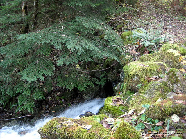
Finding the trail can be trickiest part of this hike, as it is unsigned. From the Upper Twin Falls Trailhead, take the spur up to Iron Horse Trail and head right. Keep an eye out for a small trail to your left, not more than a few hundred feet after you get on the Iron Horse. Depending on the time of year it can be a little overgrown. Once you find the trail and start up, the route becomes increasingly rocky, as it wanders through alder and maple, past streams and waterfalls. Before long you’ll encounter the first of many rock walls that attract the bouldering and climbing crowd. On summer days you’ll see climbers roped in and clambering up rock walls just off the trail.
 The first couple of miles of trail are the most difficult. Expect long and steady inclines. At two miles or so you’ll hit the Owl Hike Spot, a small viewpoint carved out of the trees opposite a sheer rock wall. Years ago, the Mountaineers had a number of Owl Hikes - short hikes close to the city that could be done after work and into the evening - though today this turnaround point seems to be the only lingering legacy of the Owl Hikes. The spot offers some good views of Rattlesnake Ledge, Cedar Butte and Rattlesnake Lake, and wall serves as a makeshift bench for taking it all in. From here on out the trail is pretty friendly, mild inclines intermingled with lengthy distances of level ground.
Eventually you’ll break out of the trees and into meadows revealing a spectacular view of Mt. Rainier presiding over the Cedar River Watershed. From the summit you can easily pick out Little Si, Mt. Si, Mt. Teneriffe and Green Mountain. Mailbox Peak to the immediate northeast, peeking out from behind another ridge of Mt. Washington. Soak up the view and enjoy.
 The is an engaging route. The trail regularly transforms itself from friendly ex-logging road - spacious, flat, and graveled - to intermittent streambed, complete with water-carved contours and exposed rock. It’s not a particularly easy hike, but the views are excellent. As an added bonus this trail is a little under the radar, so it makes a great alternative to Mailbox or Mt. Si on a summer weekend.
To get there, take I-90 to Exit 38 and head right. Almost immediately, take a right onto a gravel road to the Upper Twin Falls Trailhead. -Nathan
Print Google Directions >>
10 Comments:
This is a great blog. I hiked Mt. Si(did the scramble!) and Mt. Tenerife Kamikaze Trail(a stairclimb!) on ascent but the logging road on my way down. I'm onto Mt. Washington soon. Good luck and happy hiking!
John Jorde
Just an FYI, the parking lot is not marked for Twin Falls. At least not anymore. It is however the first right after you turn off the exit ramp. There is a sign for Ollalie State Park there.
Ah, I see the problem. Funny, we were so focused on getting the directions to the trail head right, we lost sight of getting you to the parking lot! We've updated, hopefully it is more clear now.
Is the parking lot on state park or department of natural resources land?
Hi, the parking lot is in Olallie State Park so you'll need a Discover Pass to park there.
Thanks for the heads-up to one of the best hidden gems in the Northwest. The peak had some of the most amazing views of Mt. Rainier and the Cedar River Watershed. Absolutely spectacular.
Glad you were able to go, Unknown! This is one of our favorite hikes, and we keep finding ways to go back to the area. We're thinking of trying to do a loop later this year from the Change Creek Trail to the top of Washington then back down the Mt. Washington Trail. Should be fun!
We took today off from work and did this hike as a moderate-to-hard training trail. Snow free and 100% free of foot traffic. It was unbelievable! 360-degree views at the tops with nothing but the sound of bees in wildflowers. Were it not also for the constant swarms of mosquitoes, we would have stayed at the summit longer. Thanks for taking us off the busier trails. We really enjoy your site.
-- Amy S.
There was still snow as of 6/9/2012 towards the top but nothing to make you turn back if you didn't have snow shoes. Love this hike.
-Aaron
Hi Aaron, Thanks for the update on conditions! Agreed. Fantastic hike. :)
Post a Comment