about us | links | permit info
Subscribe to Hiking With My Brother Email Subscribe Follow Hiking With My Brother on Facebook Follow Hiking With My Brother on Twitter Hiking With My Brother Picasa Hiking With My Brother YouTube

Lake of the Angels via Putvin Trail #813

Our Hiking Time: 6h 45m
Total Ascent: 3400ft
Highest Point: 4950ft
Total Distance: 7 miles
Location: N 47° 35.8200, W 123° 16.3440
Required Permit: None
Difficulty: Hard

Nathan's PhotoWe headed back over to the Olympic Peninsula to take on a famously obscure hike of legendary proportions. With names like the Valley of Heaven and St. Peter’s Gate, we anticipated a trip to the Lake of Angels would be stunning – and it delivered.

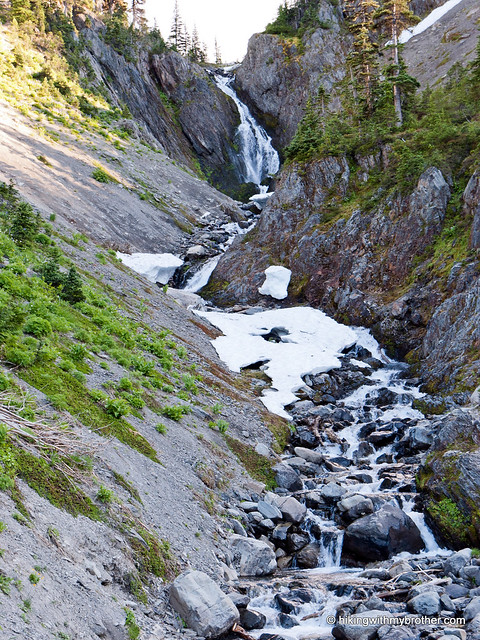
While we highly recommend this hike, it’s definitely not for the unprepared. It’s not the most difficult hike we’ve ever done, but the Lake of Angels was certainly challenging to get to. At the same time, many guidebooks give the impression that this trail requires some serious mountaineering skills to tackle – this is not the case. While there is one very small section that will probably require you to use some handholds to help you climb up the roots and rocks, that’s as harrowing as it gets. lake of angels valley of heaven hiking with my brotherIf you’re a strong hiker and are looking for something a little out of the ordinary, this is definitely a trail to check out. There are a few wilderness campsites around the lake, making an overnight an easy option. From the lake there is access to a variety of destinations including Hagen Lake or Mt. Stone and the Stone Ponds via a pass known as St. Peter’s Gate.

There's a lot more to Lake of the Angels, and you can learn all about it in our book, Hiking Through History Washington.  You'll find a trail map, route descriptions, history, and more for this and many more hikes throughout the State.  Help support hikingwithmybrother.com and the work we do by picking up a copy!
To get there, take I-5 south to Olympia to Exit 104 toward Aberdeen and Port Angeles. Follow US 101 along Hood Canal almost 49 miles through Shelton and Hoodsport to FR 25, also known as the Hamma Hamma River Road. Take a left and follow the road 12 miles to the trailhead just beyond Boulder Creek. The last five miles of the road are unpaved and have seen some washouts. A high clearance vehicle is recommended. -Nathan

Print Google Directions >>
Lake of the Angels

Upper Royal Basin via Royal Creek Trail #832

Our Hiking Time: 12h
Total Ascent: 3000ft
Highest Point: 5700ft
Total Distance: 16 miles
Location: N 47° 49.2780, W 123° 13.1160
Required Permit: Northwest Forest Pass
Difficulty: Moderate

Nathan's PhotoIt has been a long time coming, but this week we finally hopped a ferry and did our first hike in the Olympics. Despite the logistical hassle of ferries and extra driving time, we were excited to explore some new territory. We decided to start with the heavily traveled and ever-popular Royal Basin, one of the jewels of the Olympic National Park’s rain shadow region.

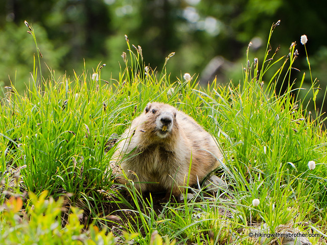
This is an excellent hike, one that we recommend you consider for a weekend backpack. The distance from Seattle and the length of the hike makes this a very long day if you’re not planning on anroyal basin hikingwithmybrother overnight. Though, on a sunny day the Royal Creek Valley is picturesque in and of itself, making a shortened version of this hike well worth the effort. Although definitely a popular and well-known hike, we did not encounter that many people along the way. In fact, we ran into more wildlife than people – not only a countless number of deer, but marmots and a few close

There's a lot more to Royal Basin, and you can learn all about it in our book, Hiking Through History Washington.  You'll find a trail map, route descriptions, history, and more for this and many more hikes throughout the State.  Help support hikingwithmybrother.com and the work we do by picking up a copy!

To get there, take the Bainbridge Island Ferry, following State Route 305 through Poulsbo to State Route 3. Follow SR 3 to the Hood Canal Bridge, taking a left over the bridge onto State Route 104. Follow SR 104 as it merges onto US 101 and continue another 18 miles and turn left onto left on Palo Alto Road. From here, take a right onto FR 2880 near the Dungeness River. Continue just under two miles to FR 2870. Head left and follow for six-and-a-half miles to the trailhead. -Nathan

Royal Basin

Blanca Lake Trail #1052

Our Hiking Time: 4h 40m
Total Ascent: 3400ft (2700ft in; 700ft out)
Highest Point: 4700ft
Total Distance: 7.5 miles
Location: N 47° 56.0760, W 121° 20.5920
Required Permit: Northwest Forest Pass
Difficulty: Hard

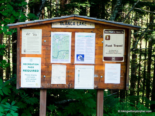
Nathan's PhotoThe bright blue skies of a September weekend were enough to push us to tackle an alpine lake that’s been on our list for years: Blanca Lake. The hike is known for the vivid colors of the lakewater and a relentless series of switchbacks gaining nearly 3000ft in three miles. We expected a challenge and Blanca Lake delivered.

blanca lake hikingwithmybrother

We recommend this hike for most hikers, though some will find the elevation gain a little too taxing. Of course, as we mentioned, Lake Blanca attracts quite a few hikers, and you can expect quite a bit of company when you make the trek. However, this isn’t a hike to do early in the season to avoid the crowds, as the lake needs to thaw in order to reveal its trademark colors. This is definitely a destination for those hikers looking for something a little different – Lake Blanca is not your typical alpine lake.

There's a lot more to Blanca Lake, and you can learn all about it in our book, Hiking Through History Washington.  You'll find a trail map, route descriptions, history, and more for this and many more hikes throughout the State. Help support hikingwithmybrother.com and the work we do by picking up a copy!

To get there, take Highway 2 out past Skykomish to milepost 50. Take a left onto FR 65, also known as the Beckler River Road. Continue for almost seven miles to a junction and pavement end. From here continue north for just under six miles to a 5-way intersection known as Jack Pass. Take the second left and continue two-and-a-half miles to FR 63. Turn right and drive two miles to the trailhead. -Nathan

Print Google Directions >>
Blanca Lake
Copyright 2008-2016 - hikingwithmybrother.com
hikingwithmybrother@gmail.com