Total Ascent: 3700ft
Highest Point: 6000ft
Total Distance: 10.5 miles
Location: N 47° 58.9980, W 121° 27.9240
Required Permit: Northwest Forest Pass
Difficulty: Hard
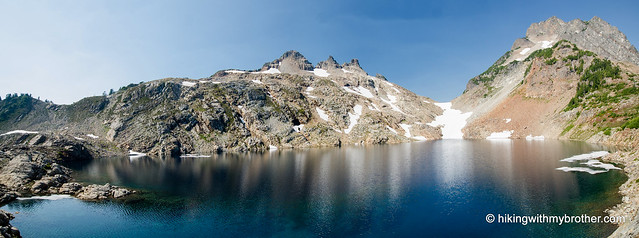
 Last week we headed out to Barlow Pass and the Monte Cristo trail to explore Gothic Basin, a popular area filled with ice-carved lakes and rocky cliffs. Everything we’d seen and heard about this hike promised a beautiful lunar landscape with big views, meadows and alpine lakes and Gothic Basin did not disappoint.
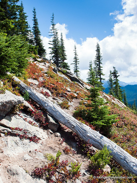
This is a challenging hike that is not for everyone, but Gothic Basin is well worth the effort. The area is simply stunning. In the few weeks that Foggy Lake is melted out each year, its icy waters exude a gorgeous deep
 blue color. There are also a number of truly amazing campsites that offer privacy and choice views. We highly recommend this hike to anyone that is comfortable with the elevation gain along a moderately rough trail. Make sure to do a little research on the conditions in the basin before you go, as the experience is better if the area is melted out.
There's a lot more to Gothic Basin, and you can learn all about it in our book, Hiking Through History Washington. You'll find a trail map, route descriptions, history, and more for this and many more hikes throughout the State. Help support hikingwithmybrother.com and
 the work we do by picking up a copy!
To get there, take I-5 North to Exit 194. Follow Highway 2 for about two miles. Stay in the left lane and merge onto Lake Stevens Highway 204. Follow for two miles to Highway 9. Take the left onto Highway 9 toward Lake Stevens. In just under two miles, you’ll reach Highway 92 to Granite Falls. Take a right and follow for about nine miles to the Mountain Loop Highway. Take the MLH for 31 miles to Barlow Pass. Park and find the gated Monte Cristo Road on the right side of the road, opposite the trailhead parking lot.
Print Google Directions >>