Our Hiking Time: 4h 15m
Total Ascent: 700ft
Highest Point: 2800ft
Total Distance: 6.3 miles
Location: N 47° 42.6840, W 121° 42.6840
Required Permit: Northwest Forest Pass
Difficulty: Moderate
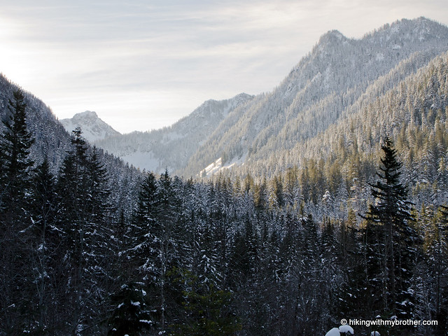
Some days are meant for snowshoeing: cold and crisp, with just enough sun to give the snow an extra sparkle. Finding ourselves facing a perfect day for strapping on our snowshoes, we packed up to explore a section of reclaimed railroad grade known as the Iron Goat Trail.
With nine miles of trail and three different trailheads, the Iron Goat Trail has more than enough to explore. The trail between Martin Creek Trailhead and Scenic Trailhead is ADA accessible and stroller friendly in the summer months, and is an easy snowshoe in the winter. If you want a little extra, take a cutoff trail up to the Embro workcamp or out to Windy Point. The trail doesn’t have the remoteness and hushed silence that some of us associate with snowshoeing, but it is perfect for a last minute destination or a first-time snowshoe.
There's a lot more to the Iron Goat Trail, and you can learn all about it in our book, Hiking Through History Washington. You'll find a trail map, route descriptions, history, and more for this and many more hikes throughout the State. Help support hikingwithmybrother.com and the work we do by picking up a copy!
To get there, take US 2 out just past milepost 58 and look for the Iron Goat Interpretative Site on the left. -Nathan
Print Google Directions >>
Lime Kiln Trail
Our Hiking Time: 3h 10m
Total Ascent: 500ft
Highest Point: 750ft
Total Distance: 7 miles
Location: N 48° 6.1680, W 121° 54.9480
Required Permit: None
Difficulty: Easy
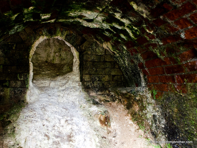
Waking to find the day overcast and already starting to drizzle, we headed out for a short hike through Robe Canyon Park near Granite Falls. We’d heard about the 6-year-old trail through an area steeped in history and a rainy day was a perfect time to explore it. We packed up our rain gear and set out for the Lime Kiln Trail.
Although the Lime Kiln Trail is a little light on sprawling vistas and pristine alpine lakes, the Robe Valley lends an air of ruggedness, and feels more remote than it is. The trail is somewhat popular, so expect some company year-round, but at about seven miles round-trip and 500’ of elevation, this little hike is a good winter hiking option. And, with a fairly mild grade and lots artifacts to play with, the Lime Kiln Trail could be perfect for a young family out for a hike.
There's a lot more to Lime Kiln Trail, and you can learn all about it in our book, Hiking Through History Washington. You'll find a trail map, route descriptions, history, and more for this and many more hikes throughout the State. Help support hikingwithmybrother.com and the work we do by picking up a copy!
To get there, take I-5 North to Exit 194. Follow Highway 2 for about two miles. Stay in the left lane and merge onto Lake Stevens Highway 204. Follow for two miles to Highway 9. Take the left onto Highway 9 toward Lake Stevens. In just under two miles, reach Highway 92 to Granite Falls. Take a right and follow for about eight miles to a four-way stop in Granite Falls. Take a right onto Granite Ave, and in three blocks a left onto Pioneer St. Continue for a little over a mile as the road changes to Menzel Lake Rd, and veer left onto Waite Mill Rd. Continue for a half mile to the school bus turnaround, and take the left branching gravel road to the trailhead. - Nathan
Print Google Directions >>
Subscribe to:
Posts (Atom)