Total Ascent: 100ft
Highest Point: 650ft
Total Distance: 8 miles
Location: N 48° 5.6160, W 123° 48.1440
Required Permit: None
Difficulty: Easy
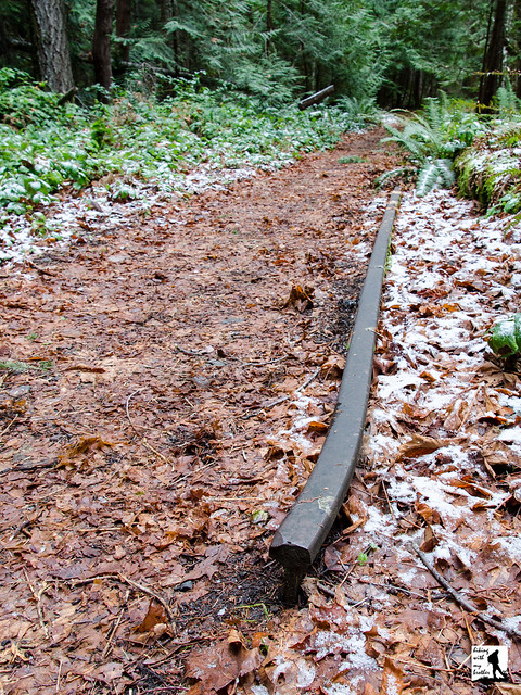
 During the winter months we often switch between snowshoeing beneath snow-heavy trees and brisk lowland hikes along rivers and lakes. A few weeks ago we opted for the latter and took a drive out to the Olympic Peninsula to Lake Crescent and the Spruce Railroad Trail.
Two trailheads serve the Spruce Railroad Trail, allowing hikers to start at either end, or take two cars and shuttle between the trailheads for shorter hike. From the eastern trailhead, the route begins easily, following the bones of one of the many logging roads built to bring lumber down to the railway. This trail is a great winter hiking option as the lake tends to minimize the snow. It is relatively flat, with just a few portions of elevation as the trail deviates from the railbed,
 making it a good choice for bringing along the whole family or maybe some of your non-hiking friends. This is also a mixed use trail, and one that allows mountain bikes and stock. So you can expect a variety of company along the way during the warmer months. Currently a project is underway that will re-route and pave portions of the trail, re-open the tunnels and add new sections to the trail, all with the intent of bringing more traffic to the area. Whatever the effect of this change, the Spruce Railroad Trail will continue to be a decent winter hike well into the future.
  There's a lot more to the Spruce Railroad Trail, and you can learn all about it in our book, Hiking Through History Washington. You'll find a trail map, route descriptions, history, and more for this and many more hikes throughout the State. Help support hikingwithmybrother.com and the work we do by picking up a copy!
 To get there, take the Bainbridge Island Ferry, following State Route 305 through Poulsbo to State Route 3. Follow SR 3 to the Hood Canal Bridge, taking a left over the bridge onto State Route 104. Follow SR 104 as it merges onto US 101 and continue another 36 miles to Port Angeles, taking a left on Lincoln Street to stay on US 101. Continue 17 miles to East Beach Road and take a right. Continue for about 4 miles, crossing the Lyre River to a road signed Spruce Railroad Trail. Take a left and find the parking for the trailhead where the public road ends. -Nathan
Print Google Directions >>