about us | links | permit info
Subscribe to Hiking With My Brother Email Subscribe Follow Hiking With My Brother on Facebook Follow Hiking With My Brother on Twitter Hiking With My Brother Picasa Hiking With My Brother YouTube

Snoquera Falls Loop Trail #1167

Our Hiking Time: 2h 30m
Total Ascent: 900ft
Highest Point: 3400ft
Total Distance: 3.8 miles
Location: N 47° 2.3820, W 121° 33.1860
Required Permit: Northwest Forest Pass
Difficulty: Easy

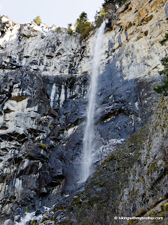
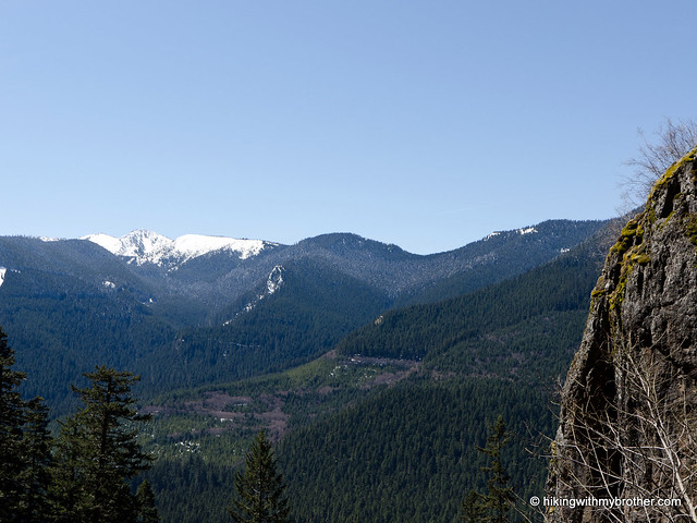
Nathan's PhotoWith the sun making an appearance, this week we decided to head back out to SR 410 to explore Snoquera Falls. This gentle 4-mile loop to a somewhat secluded waterfall with only moderate elevation gains was exactly the speed we were looking for.

This was a great hike that we would recommend to almost anyone. It’s not often that such an impressive waterfall is so easily accessible – although the short route up to the base of the falls is a bit of a scramble. snoquera falls hikingwithmybrotherThe short climb up to the base of the falls somehow feels much more remote than it actually is. As an added bonus, you can hike this trail nearly year-round, with the falls putting on a different show depending on the season. A popular destination for sledding in the winter and camping in the summer, you can minimize the company by trying this hike in the spring.
There's a lot more to Snoquera Falls, and you can learn all about it in our book, Hiking Through History Washington.  You'll find a trail map, route descriptions, history, and more for this and many more hikes throughout the State. Help support hikingwithmybrother.com and the work we do by picking up a copy!

To get there, take I-5 south to Highway 18 Exit 142A. Follow Highway 18 into Auburn and take the SR 164 exit. Head left on SR 164 through Enumclaw to SR 410. Head left onto SR 410 for 32 miles to Camp Sheppard just past the Dalles campground. -Nathan

Print Google Directions >>
Snoquera Falls

Boulder River Trail #734

Our Hiking Time: 4h 15m
Total Ascent: 700ft
Highest Point: 1560ft
Total Distance: 8.2 miles
Location: N 48° 13.1220, W 121° 46.7100
Required Permit: None
Difficulty: Easy

Nathan's PhotoThis week, we were looking for a gentle hike that would not be too taxing on my still-recovering foot. After some research we settled on a fairly popular riverside hike in the Darrington area: the Boulder River Trail.

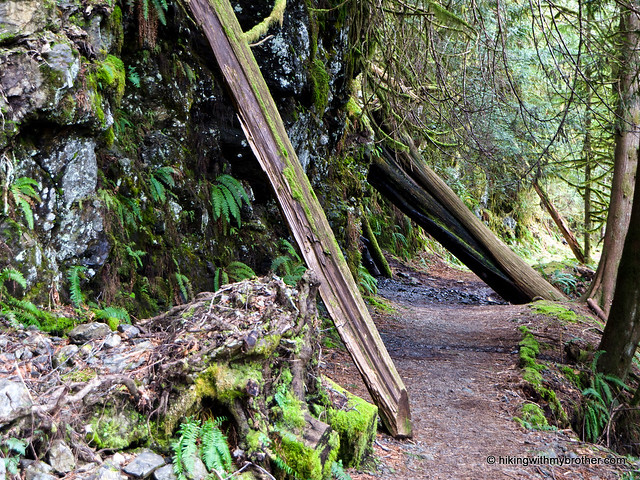
It’s unsurprising that the Boulder River Trail is a popular hike. This trail gently takes you through a dramatic and impressive landscape. Once beyond Feature Show Falls, the forest becomes moss-laden and heavy, losing much of the undergrowth prominent in the early portions of the trail. The river boulder river trail feature show falls hikingwithmybrotherremains a nearly constant companion, always within hearing distance even as it slips from view. Creeks cut across the trail, winding down to the river in contrast to the more dramatic cascades on the opposite bank. Even the wildlife was unexpected: water ouzels, wood ducks and hummingbirds all made an appearance. With only a few hundred feet of elevation gain and worthy destinations early-on, this trail is an excellent way to give children or the reluctant hiker a taste of the wilderness. One caution: when we hiked this trail, there were a couple of significant blowdowns that were a little tricky to navigate. Most hikers shouldn’t have much of a problem with these.

There's a lot more to Boulder River, and you can learn all about it in our book, Hiking Through History Washington.  You'll find a trail map, route descriptions, history, and more for this and many more hikes throughout the State.  Help support hikingwithmybrother.com and the work we do by picking up a copy!

To get there, take I-5 north to Exit 208 and drive east on SR 530 for about 19 miles to milepost 41. Immediately after the milepost, turn right onto FR #2010 – some maps call this French Creek Road, but it’s not well signed. Follow the unpaved road almost four miles to its end and the trailhead. -Nathan

Print Google Directions >>
Boulder River

Mud Mountain Rim Trail

Our Hiking Time: 3h
Total Ascent: 400ft
Highest Point: 1300ft
Total Distance: 5 miles
Location: N 47° 8.7000, W 121° 56.0400
Required Permit: None
Difficulty: Easy

Nathan's PhotoAfter weeks of being laid up with a fairly severe heel injury, we’re finally back on the trail. Unfortunately, bone bruises need months to fully heal, so we’re easing back into our hiking routine, sticking to moderate elevations and well-maintained trails. The Rim Trail at Mud Mountain Dam fit the bill perfectly, and gave us a chance to head back out to the 410 area in some nicer weather.

mud mountain dam recreation area hikingwithmybrotherThis gentle multi-use trail is open to bikers, equestrians, and hikers. Accessible all year, this is a perfect option for an off-season hike. The playground and picnic area makes for a nice family outing during the summer, and the Rim Trail is toddler-friendly enough to bring the whole family on. Although the trail is over six miles long, there are multiple access roads that break up the distance, offering the opportunity to explore the trail in smaller sections. Relatively close to civilization and easy, this hike is a good excuse to dust off your gear and get a jump on hiking season.

There's a lot more to Mud Mountain Rim Trail, and you can learn all about it in our book, Hiking Through History Washington.  You'll find a trail map, route descriptions, history, and more for this and many more hikes throughout the State. Help support hikingwithmybrother.com and the work we do by picking up a copy!

To get there, take I-5 south to Highway 18 Exit 142A. Follow Highway 18 into Auburn and take the SR 164 exit. Head left on SR 164 through Enumclaw to SR 410. Head left onto SR 410 for a few miles to the well-signed Mud Mountain Road. Take a right and continue about 2 miles to the Mud Mountain Recreation Area. You can opt to park inside the gates during the summer, but keep an eye on the time – they close at 4pm. -Nathan

Print Google Directions >>
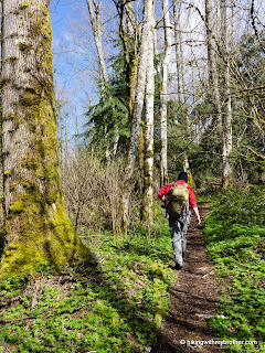
Mud Mountain Rim Trail
Copyright 2008-2016 - hikingwithmybrother.com
hikingwithmybrother@gmail.com