Our Hiking Time: 4h
Total Ascent: 1600ft
Highest Point: 4400ft
Total Distance: 8.5 miles
Location:
N 47° 27.8580, W 121° 26.7945
Required Permit:
Northwest Forest Pass
Difficulty: Moderate
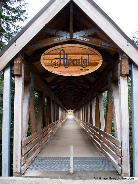
We try to follow one simple rule when choosing a hike: avoid climbing a peak on a cloudy day. So, when sunshine did not seem to be in our future as we prepared ourselves for our hike this week, we headed toward Alpental and the hike to Snow Lake we had been hearing friends rave about for years.
Tucked on the slopes of recent resident to this area of Snoqualmie pass, having operated there since 1967. Various landlords have held fleeting ownership long before, including the mountain’s namesake, Authur Denny, who staked mining claims in the area while prospecting for iron ore back in 1869.
Denny Mountain, Alpental is only the most
Following in Denny’s wake, mining claims proliferated throughout the valley including parts of Snow Lake. As the years passed, these claims were sold or abandoned, slowly becoming either part of Alpental or what would become the Alpine Lakes Wilderness.
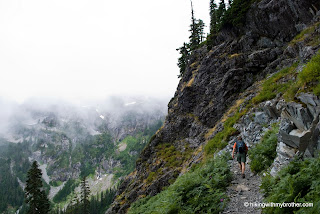
The popular Snow Lake Trail #1013 begins mildly, cutting a long swath through fields of bracken fern and salmonberry before entering a forest of hemlock and fir. As you slowly gain elevation, navigate your way across talus fields and cascading streams. Enjoy the well-trod path, beaten down by tens of thousands of boots every year keeping it clear of debris and encroaching brush. At two miles, the trail meets up with the signed Snow Lake Trail #1013.2, the Source Lake Overlook trail, which served as the primary route to Snow Lake before washouts prompted the building of a more direct route over the cliffs. Follow the new route to the right, switchbacking steeply up the rocky ridge, entering the Alpine Lakes Wilderness at the top.
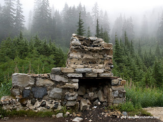
From the ridgeline, the trail descends to shores of Snow Lake. At a mile long, Snow Lake is large for its breed; placid waters wrap around Chair Peak obscuring its western reaches. Remnants of a cabin – chunks of low stone walls and the remains of a fireplace – crumble on the lakeshore, as they have since at least the 1960s, though sadly no one seems to know the story behind it. The vegetation around the lake is riddled with footpaths, lingering evidence of the multitudes struggling to find their own private slice of solace near the water.
On the hike back out, we decided to spend the extra time exploring the Source Lake Overlook and were well rewarded. Largely abandoned since the new route opened, the trail is rough and unmaintained, making it difficult to navigate at times. However, the path takes your through small alpine meadows, past tiny lakelets, and under a small waterfall, and it is far less crowded that the main trail. By the time Source Lake is in view, the trail improves greatly, mostly by virtue of the adventurous clambering up the scramble route to The Tooth and Chair Peak located here.

Snow Lake is not only beautiful, its very accessible – just three miles to the lake and most of that distance is relatively flat – which is likely what attracts so many hikers year after year. It should be noted that if solitude is your goal, this hike should be avoided. We hit the trail quite early on a weekend, and although we enjoyed some relative peace and quiet on the way up, we had to fight our way back down the trail, stopping every few minute to dance around groups heading up to the lake. If you do decide to brave the crowds, we highly recommend exploring the Source Lake Overlook for a respite from the throngs.
To get there, take I-90 to exit 52. From the exit, take a left onto Alpental Road for about two miles to a large gravel parking lot. The trailhead is across the road to the right. - Nathan
Print Google Directions >>


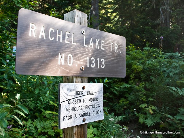
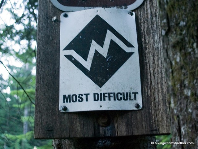
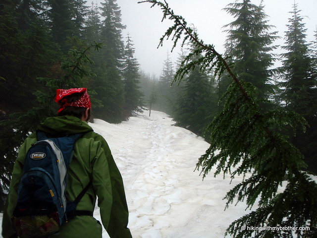
 Although the trail is challenging, making this hike feel more difficult than the elevation gains would suggest, the beauty and the view more than make up for effort. Rachel Lake and Rampart Ridge hold more than can be seen in a day, making this hike perfect for a short backpacking excursion.
 for this and many more hikes throughout the State. Help support hikingwithmybrother.com and the work we do by picking up a copy!